Tieluiska Oy, an infrastructure construction expert, has reduced risks by tracking plans, inspections, as-built data, and orthophotos in real time using Infrakit. The ability to react to changes has improved, as information is quickly updated even in the field.
We discussed with Tieluiska how a digital situational overview supports site management, surveying, and daily fieldwork in complex infrastructure projects, particularly in urban environments.
Client
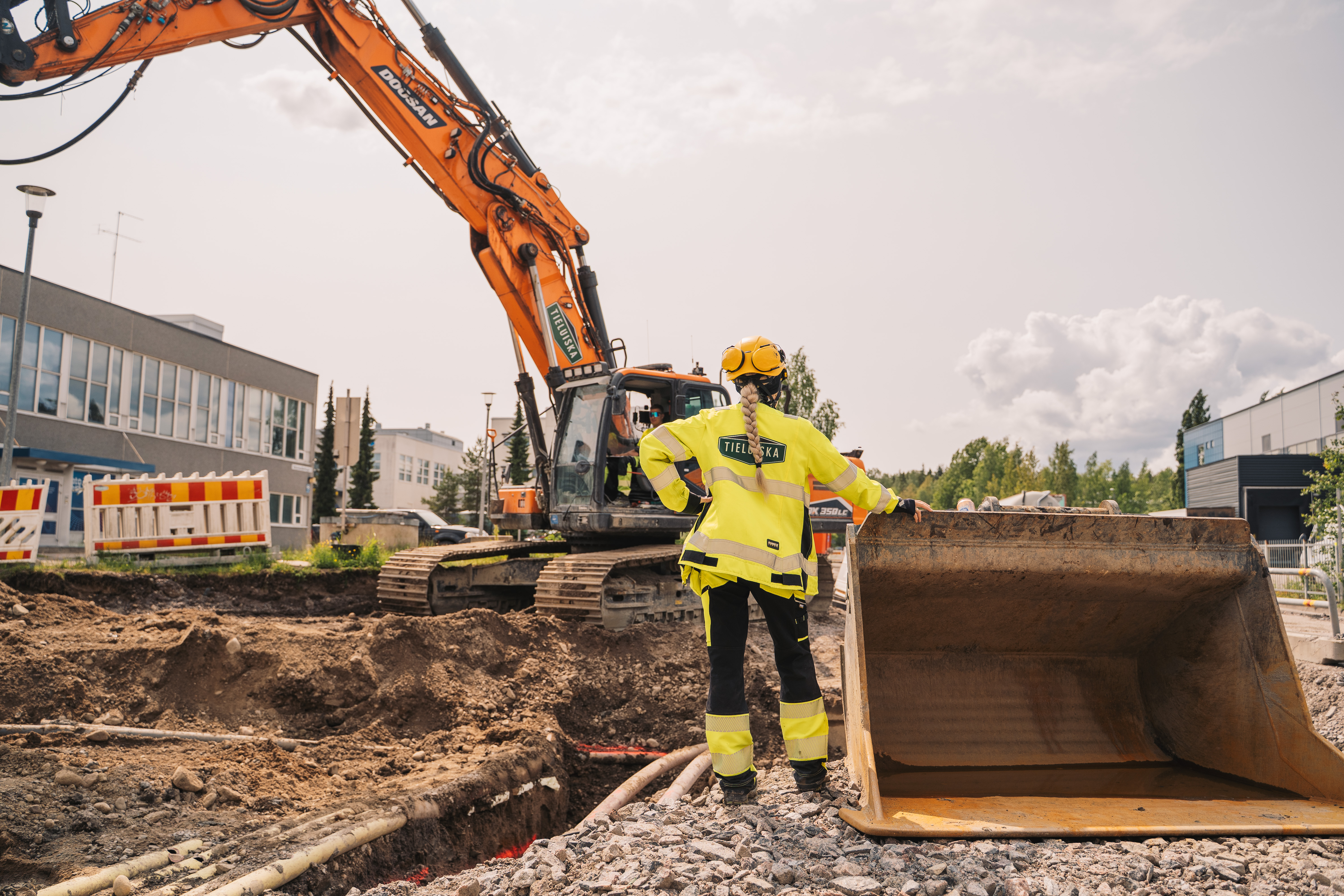
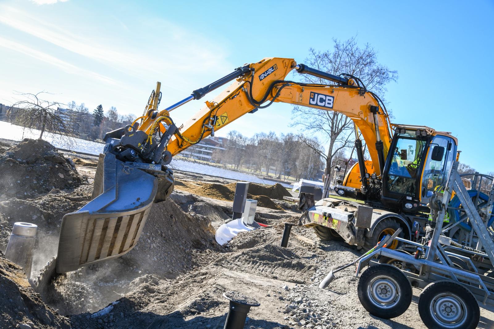
Tieluiska Oy carries out infrastructure construction projects, especially in street construction, municipal engineering, and environmental construction. Their operations focus on urban environments, where phasing, coordination of work stages, and up-to-date information management are critical.
Typical projects include street and environmental construction, green areas and sports facility construction, water and sewer rehabilitation and new builds, comprehensive municipal infrastructure contracts, and technically demanding projects in dense infrastructure environments.
Challenge: Fragmented Data and Slow Situational Awareness
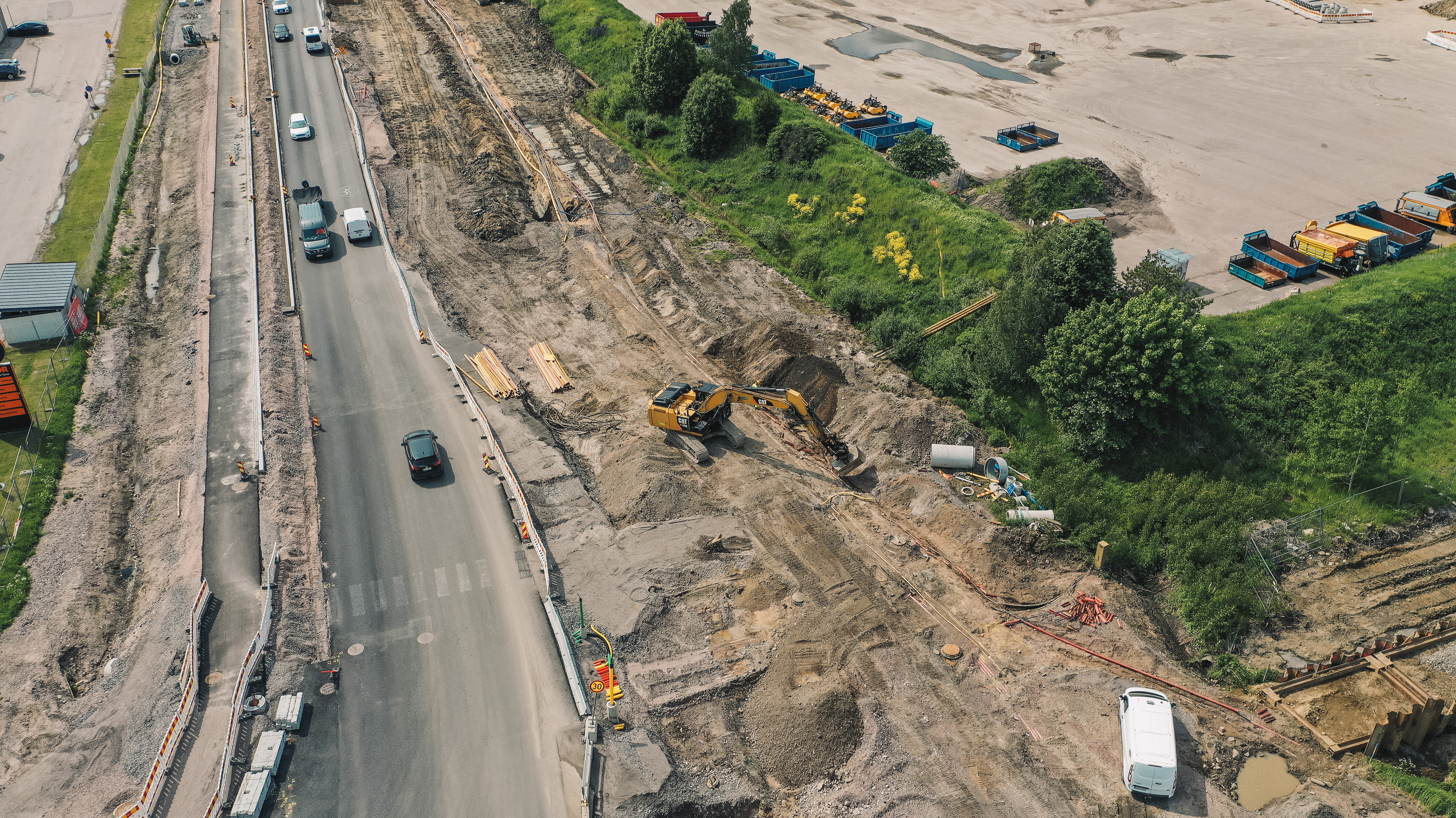
Before implementing digital tools, the main challenges were related to the timeliness, availability, and overall visibility of information. Design changes were not communicated to the field in real time, and machine control models were often updated with delays following design revisions. Data transfer was frequently handled using USB drives, which slowed work and increased the risk of using outdated data.
The site’s situational overview was built from multiple separate sources such as Excel files, site diaries, phone calls, WhatsApp messages, emails, and verbal communication. Monitoring progress and quantities were fragmented, making it slow and partially unreliable to form an overall picture.
“Project situation awareness relied heavily on phone calls and messages, which made forming a comprehensive view challenging,” says Technical Manager Esa Hytönen.
Why Infrakit Was Introduced
Infrakit became familiar to Tieluiska through industry exposure and practical trials. A key factor in adopting it was the ability to bring several essential daily site functions into one system.
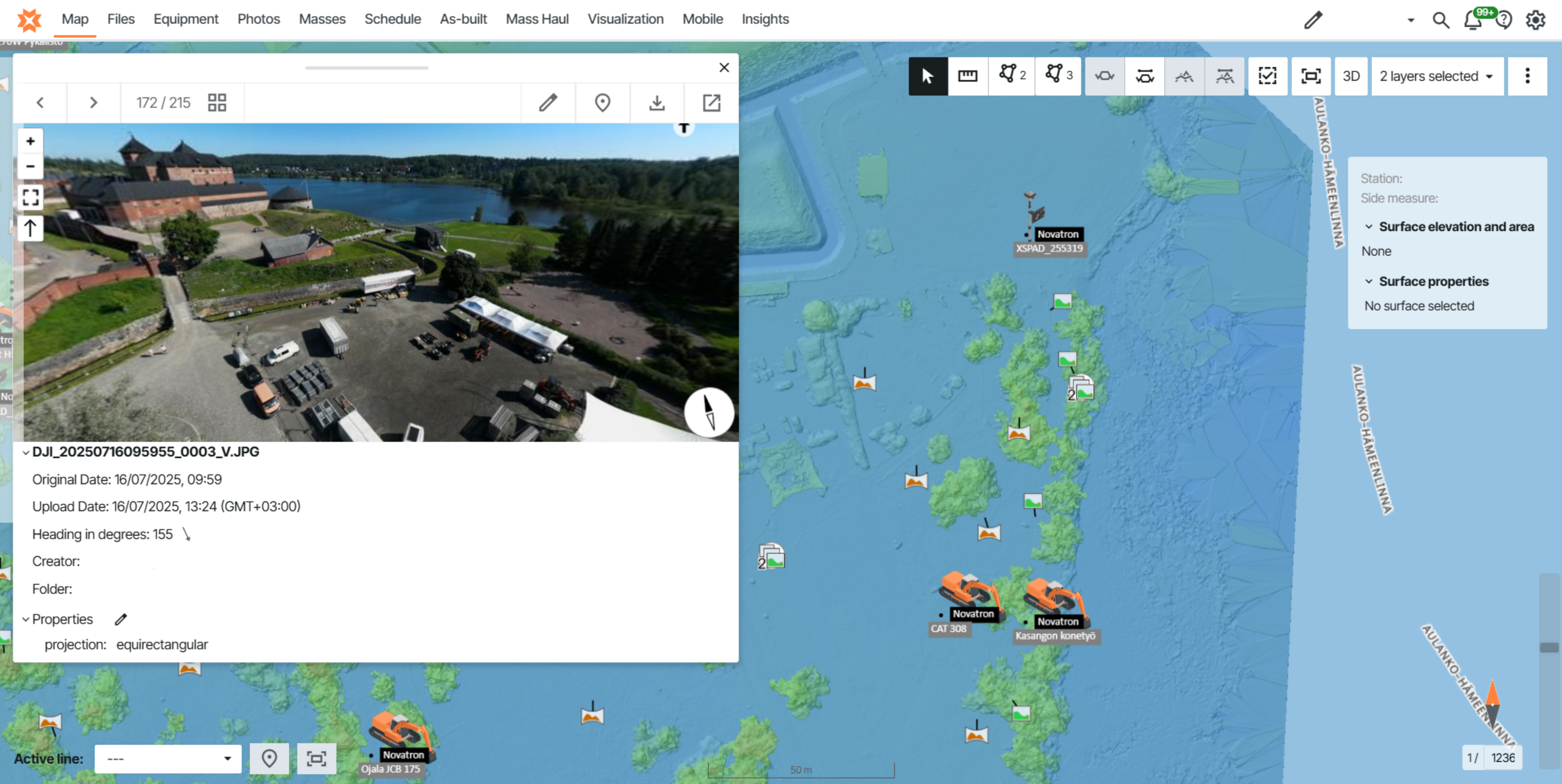
Up-to-date plans and models, field data, progress tracking, and documentation including photos had previously been scattered across different systems but are now available on a single platform.
This was not just about introducing new software but about bringing information closer to daily operations. When up-to-date information is easily accessible, reaction times shorten and work management becomes easier.
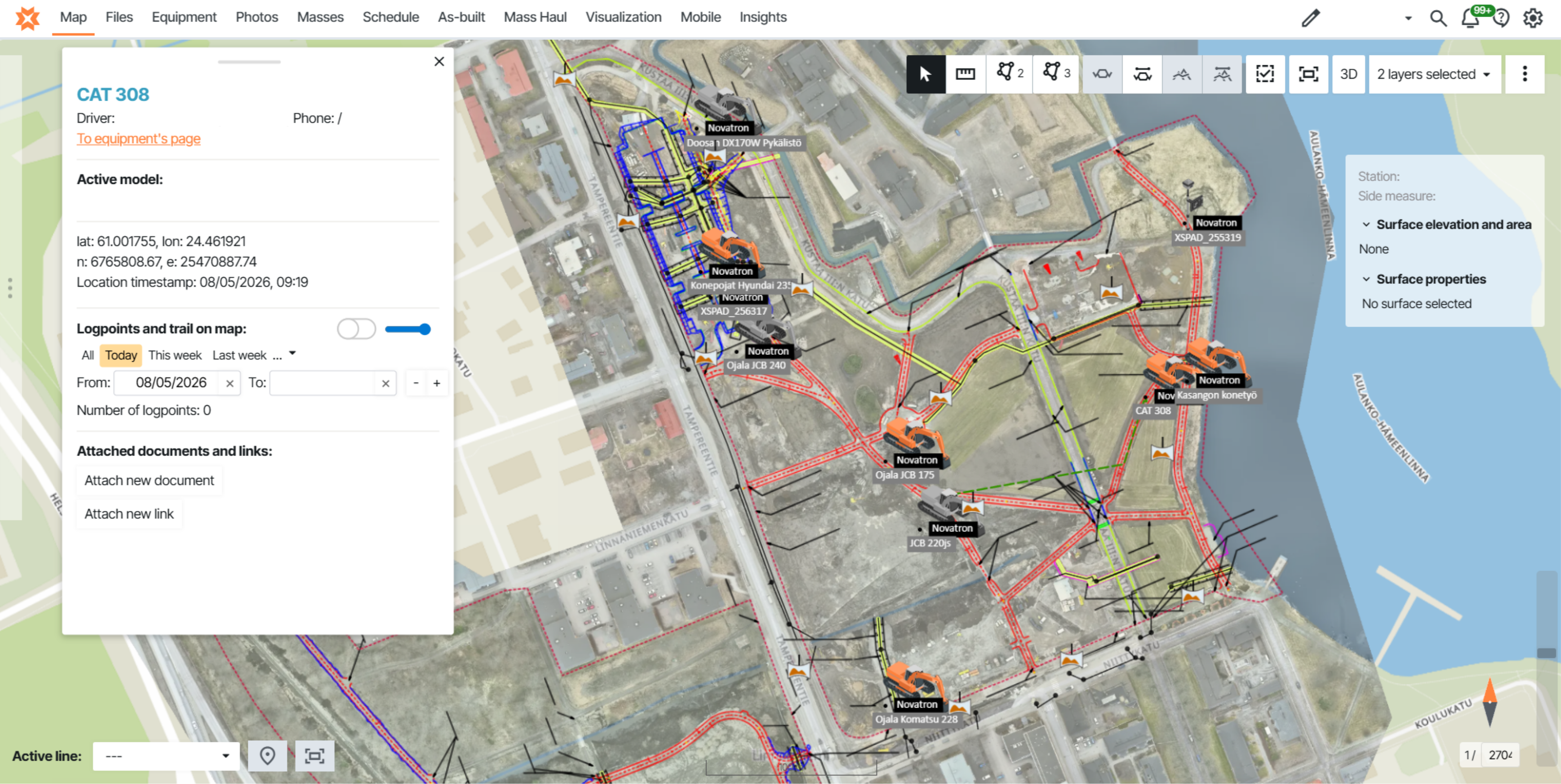
The integration of orthophotos and aerial images with planning data proved particularly beneficial. It improved work planning, supported maintaining situational awareness, and added accuracy to tracking site progress.
Implementation in Daily Work
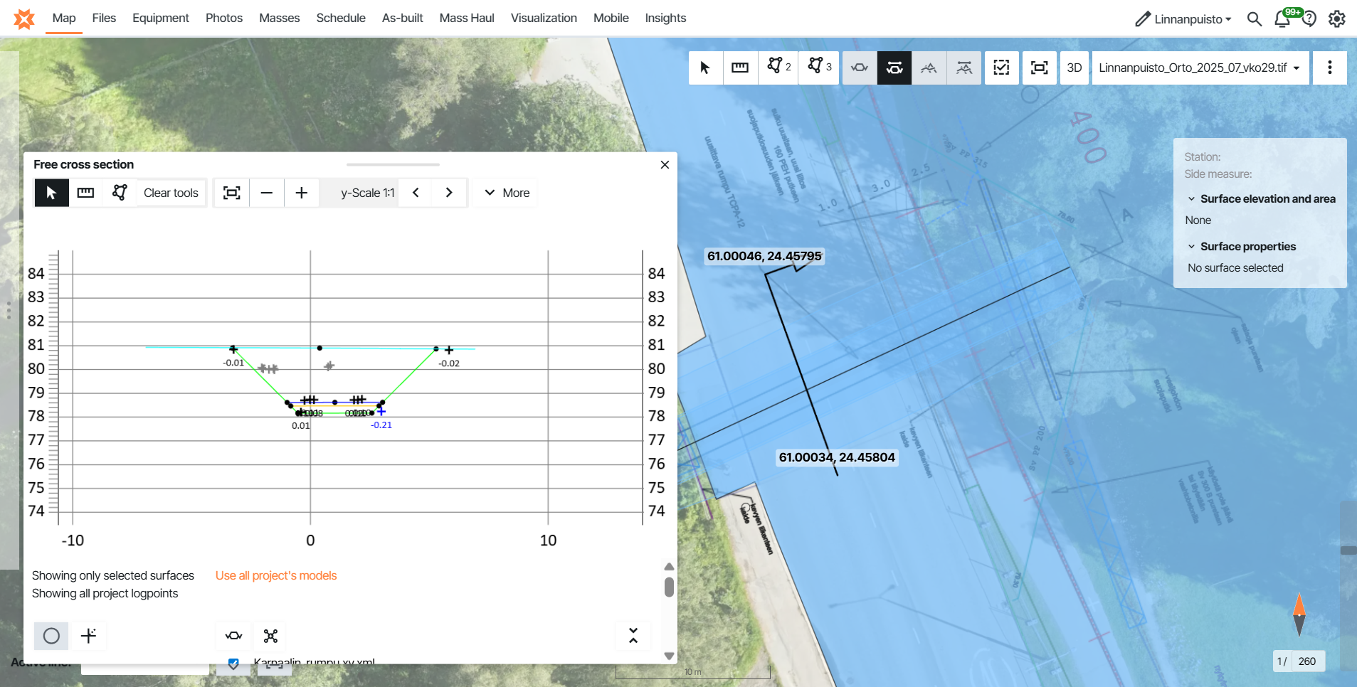
The impact of implementation varies by role. In surveying, the system quickly becomes a key tool that connects design, execution, and monitoring. All machine measurement data is available in one place.
For site managers, the biggest change is that the project’s situational overview is accessible in a single system. Retrieving information becomes faster, and tracking completion rates is clearer.
In the field, ease of use is essential. Adoption typically progresses step by step, often starting with photo documentation and expanding to other functions. Basic usage becomes natural within a few weeks, and smooth daily use is usually established within 1–2 months.
Daily Use: Three Key Workflows
Three main use cases stand out at Tieluiska:
- Up-to-date plans and models bring all essential information into a single view, reducing uncertainty and minimizing errors on site.
- Saved views support site management and allow information to be customized for different user groups, enabling each role to monitor progress from its own perspective.
- Field documentation — including photos, as-built points, and annotations — supports both internal monitoring and reporting to clients. With geolocation and timestamps, information can be found quickly and reliably later.
In practice, these workflows overlap. For example, payment approvals can use saved views that show completion status, attachments, inspection data, and as-built measurements overlaid on orthophotos, making the approval process transparent and verifiable.
Quantity tracking has also become a key application. For instance, the progress of mass stabilization can be viewed directly on a map, making work stages clearly visible by area.
“Understanding completion status is much easier when it is presented visually on a map.”
What Changed in Practice
The system has introduced greater visual clarity and transparency into production monitoring. Quantity tracking is still based on comparing planned and completed amounts, but progress can now be viewed directly through map- and model-based visualization.
Some project management functions, such as financial tracking, are still handled in other systems. Infrakit primarily serves as a production support tool that brings real-time situational awareness closer to daily operations.
Surveyor as the Information Hub of the Site
The site surveyor remains a central figure in managing information. They are responsible for ensuring that the correct data is used, maintaining as-built data, and supporting site management in decision-making. The surveyor also often acts as a link between design, production, and the client.
The system supports this role by consolidating machine control models, user permissions, and as-built data into a single platform.
Parallel Systems – Clear Division of Responsibilities
In many projects, both client systems and Infrakit are used. Responsibilities are typically clearly divided:
- The client system is used for official approvals and contract documentation
- Infrakit is used for production management and real-time situational awareness
Although parallel use can introduce some overlap, a clear division of responsibilities keeps the overall process manageable.
Results
The benefits are most evident in smoother workflows and faster response times. Less time is spent searching for information, situational awareness is formed more quickly, and inconsistencies are easier to detect.
Progress tracking is now more visual, and the use of orthophotos has become more efficient.
Esa Hytönen summarizes: “Infrakit brings information closer to production and supports daily work, especially in multi-phase projects.”
Conclusion
Although digital tools are evolving rapidly, one thing remains unchanged: construction still happens on site. Digital solutions bring efficiency and transparency, but their value emerges only when they support practical work and everyday operations in the field.