
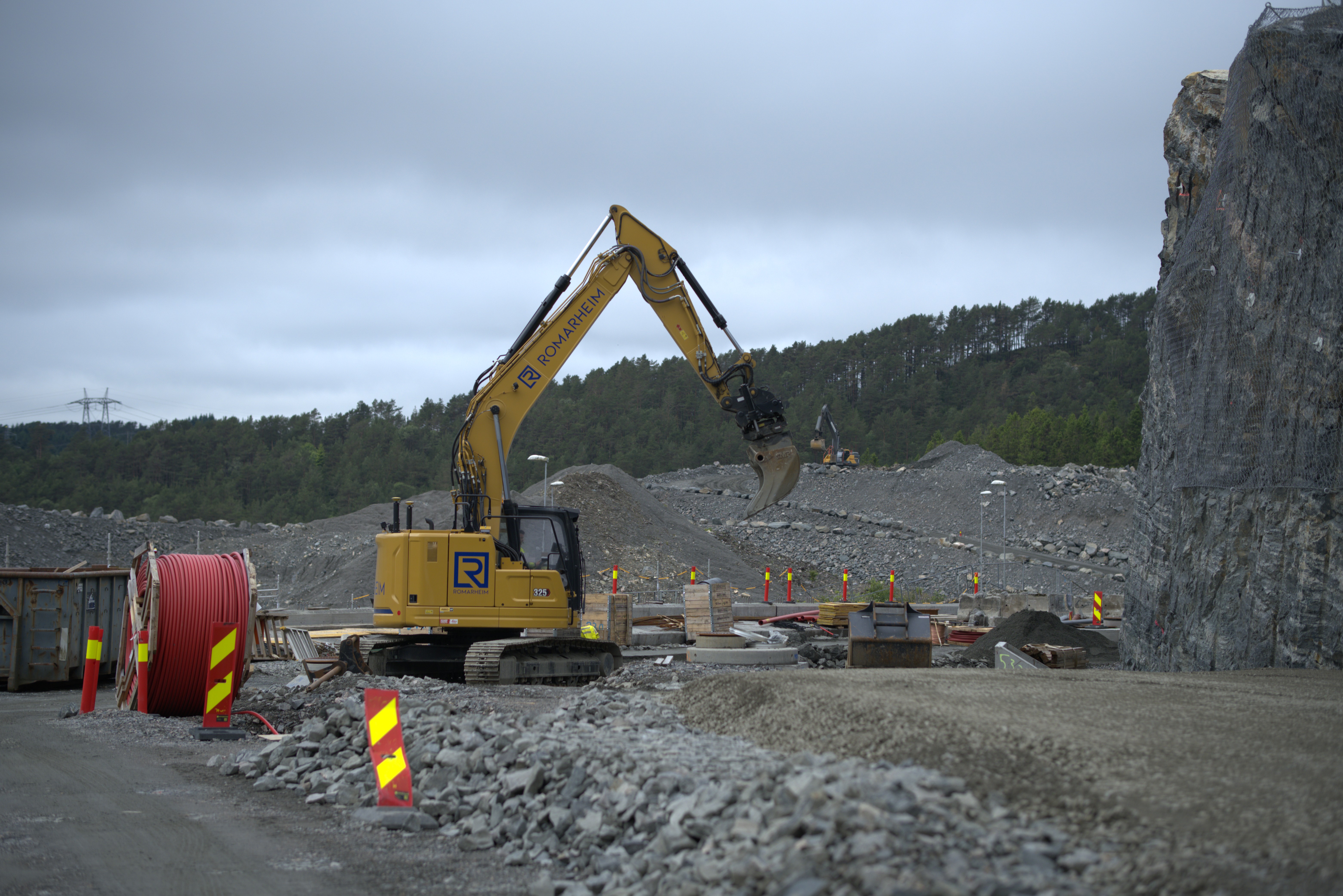
Romarheim AS has used digital tools for several years to improve the delivery of large and complex construction projects. Infrakit and Ditio are two of the systems used in its day-to-day project work. For Romarheim, the combination has become essential to managing complex infrastructure projects, providing practical tools for documentation, accuracy and efficiency on site.
One of the clearest examples is Sotrasambandet, one of Western Norway’s largest infrastructure projects. Through the joint venture Romarheim & Rivenes AS, Romarheim has spent several years working on groundworks, construction machinery operations and infrastructure around Storavatnet in Bergen municipality. In October 2025, the scope of its work expanded with a NOK 450 million contract – the largest single contract in Romarheim’s history.
A connected workflow across the project organisation
For Romarheim, Infrakit and Ditio support much more than machine control and surveying. Infrakit brings together models, survey data, machine control data, machine positions and drone imagery. Ditio complements this with checklists, information records and photo documentation. Together, the systems make relevant project information accessible to both the teams carrying out the work on site and those managing and monitoring it from the office.
Where information previously had to be coordinated manually between systems and people, project teams can now access what they need directly. This saves time and reduces the risk of misunderstandings across the project organisation.
The integration connects information from the two systems, from models, survey data, machine production data and drone imagery to checklists, information records and photo documentation.
“Infrakit and Ditio address different needs within the project, but the greatest value comes when the information is connected. It gives us a clearer link between what has been planned and what is actually being carried out on site.”
– Kasper Håland, Project Engineer at Romarheim AS
From specialist tools to a shared understanding on site
The information in Infrakit and Ditio is useful beyond the surveying and project management teams. Visualisation makes project details easier for everyone involved to access and understand, without requiring specialist technical expertise. Teams can view up-to-date models, logs and survey data to see what needs to be done and where.
When everyone works from the same information, there is less risk of work being carried out incorrectly or in the wrong location, of teams relying on outdated drawings, or of activities being poorly coordinated across disciplines. This helps reduce errors and rework and keeps the project moving.
Ditio – documentation from the field
Infrakit gives the project team an up-to-date, map- and model-based view of the project, bringing together models, machine and survey data, and geographical information. Ditio is used to document day-to-day work in the field, including photos, checklists, HSE records and information about completed activities. It is also used to monitor productivity and emissions across projects.
Information is recorded as work takes place and linked to the relevant project and activity. This helps Romarheim monitor progress, find documentation in the right context, and see what has been completed, what remains and what needs follow-up.
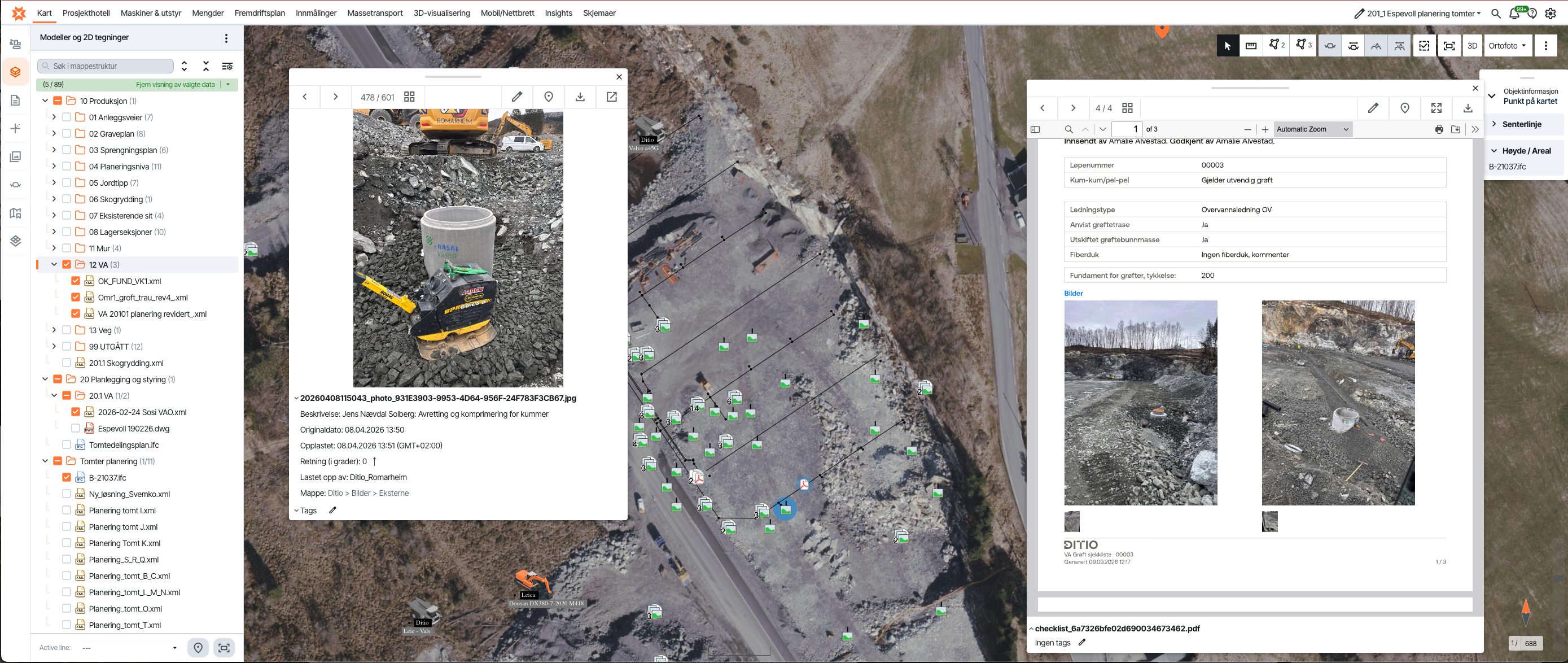
The connection between Ditio and Infrakit links field documentation to the correct geographical location and places it alongside the wider project information. Infrakit shows what needs to be done and where; Ditio documents the work carried out.
Together, the systems give Romarheim a clearer view of the connection between planned and completed work.
Precise documentation, directly on the map
Kasper Håland, Project Engineer at Romarheim, shows how the connection between Infrakit and Ditio works in practice. He says the integration has made his day-to-day work significantly more efficient, saving him several hours in a typical working week.
“For me, a big part of the integration is not having to spend time searching for information. I can move from an area or object in Infrakit directly to the documentation I need in Ditio, and vice versa. It makes it easier to find out what has been done, where it was done, and which documentation belongs to it.”
– Kasper Håland, Project Engineer at Romarheim AS
At any given time, many Romarheim employees are carrying out construction activities that must be checked against checklists and documented with photos and written descriptions. Infrakit shows the precise location of each object on the map, while drone-based orthophotos and video help keep the map data up to date. With large volumes of documentation to manage, Håland says accurate location data makes a significant difference:
“It helps a lot when objects can be identified with an exact location.”
The workflow runs in both directions. Sometimes Håland starts in Infrakit and moves to Ditio; at other times, he starts in Ditio and moves to Infrakit. This two-way connection has made daily work easier for him and his colleagues.
Although Håland already uses both systems regularly, he sees further potential to improve efficiency. In his experience, using the systems more extensively reveals new ways to streamline workflows and improve documentation.
Together, the systems give the team a clear view of the infrastructure, the work completed and the location of individual objects on a detailed map. For a large contractor such as Romarheim, where each site involves many people, activities and documents, this provides greater confidence and control.
Documentation of completed work and precise location data are recorded as work progresses. Updated information allows everyone involved to follow activities across the site. Infrakit and Ditio have become such an integral part of Håland’s daily work that he finds it difficult to imagine working without them:
“I can almost imagine the challenges I would face in my daily work if I didn’t have these tools available.”
Håland’s experience reflects what Visa Hokkanen at Infrakit sees as a key benefit of using the systems together:
“The value comes from being able to view information from the field in the context of the project’s maps, models and other project data. The integration with Ditio makes it easier to connect planned and completed work, giving the project team a stronger basis for coordination and decision-making throughout the project.”
– Visa Hokkanen, Chief Product Officer, Infrakit
Less rework, closer collaboration
On a project such as Sotrasambandet, with a long timeline, multiple disciplines and several stakeholders, effective information flow is essential. Infrakit brings together project documentation, survey data and machine control information, while Ditio tracks field documentation, HSE, productivity and emissions. Together, they give Romarheim a view of the project from the planned model through to the work completed on site.
The integration connects project information with field documentation in a continuous workflow. It reduces the need to communicate information verbally or transfer it manually between teams, and makes it easier to identify deviations in time to take corrective action.
“The value lies in putting field data into the right project context and enabling information to flow more effectively throughout the project. When documentation in Ditio is connected with maps and models in Infrakit, it becomes easier to see the relationship between planned and completed work, identify deviations earlier, and reduce the risk of errors and rework.”
– Pawel Syslo, Chief Product Officer, Ditio
Kasper Håland’s experience at Romarheim AS shows that the benefits extend beyond the organisation to the people working on the project. For Håland, this means saving several hours each week and having access to up-to-date documentation and precise location data. He also sees further opportunities to improve efficiency as the systems are used more extensively.