
Infrakit + Ditio = Stronger Together
For more than a decade, Infrakit has been a leading platform for model-based project execution in the infrastructure and construction industry. By bringing together maps, digital models, machine control, surveying, and project data in a shared digital environment, Infrakit ensures that everyone involved in a project works from the same up-to-date information.
When this model-based precision is combined with Ditio’s operational field documentation, Infrakit customers gain even greater value from their digital models.
For Infrakit, the partnership with Ditio is about creating a more complete project foundation. While Infrakit gives customers a clear overview of where to build, what the digital model looks like, and how machine control and surveying data align with the project plan, Ditio enriches that picture with operational, real-world data captured directly from the field. This gives customers a much clearer understanding of what is actually happening during production. Together, the integration brings the digital model to life.
Visa Hokkanen, Chief Product Officer at Infrakit, describes Infrakit as a platform that helps contractors and infrastructure owners deliver projects with greater precision, higher efficiency, and better control over schedules and costs. Infrakit’s mission is clear: to help projects stay on schedule and within budget.
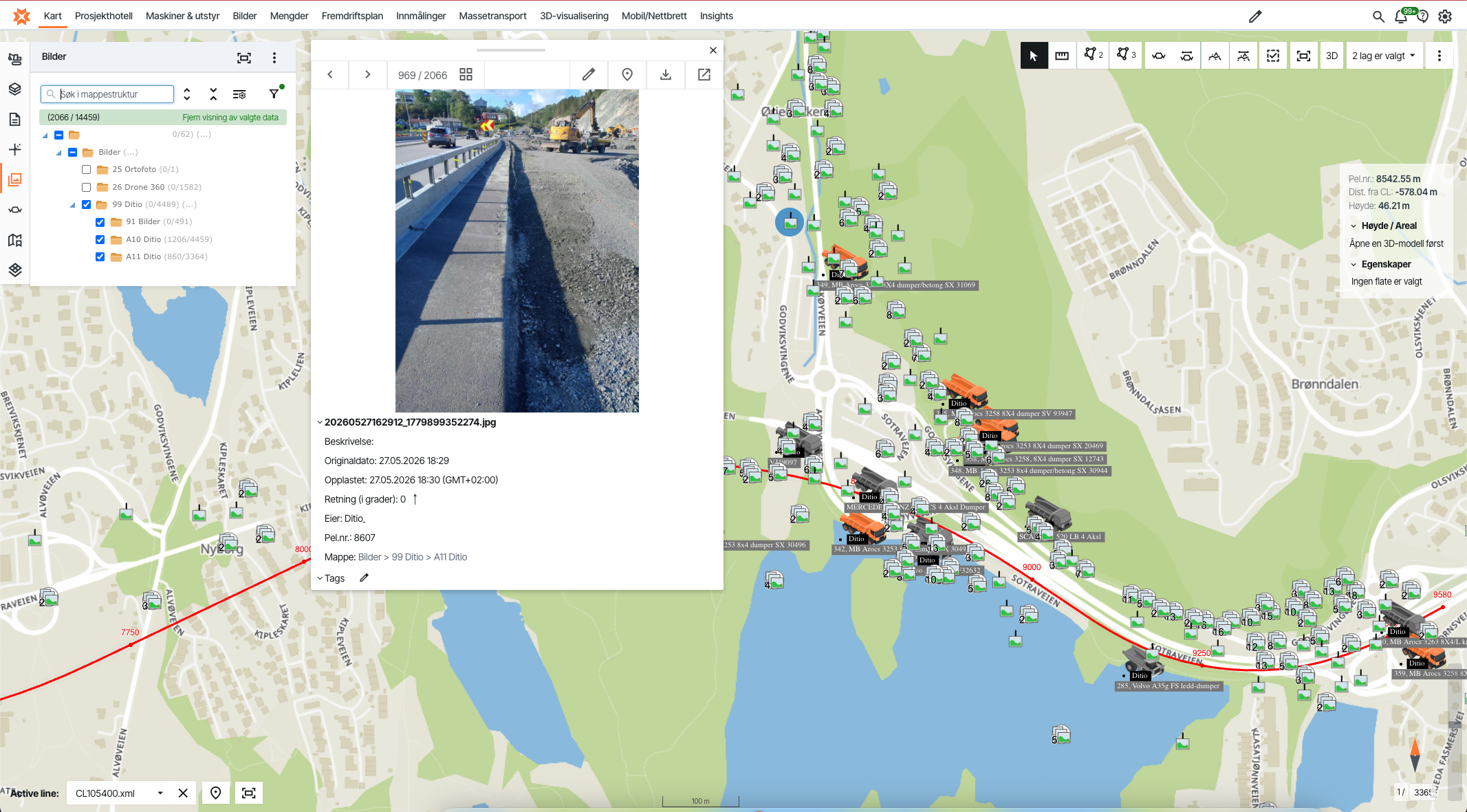
By integrating Ditio into the Infrakit ecosystem, the digital model becomes more than just a construction plan—it becomes a living representation of how work is actually being carried out on site. Real-time production data, workforce records, timesheets, photos, inspections, and non-conformance reports can all be linked directly to the visual project model. For Infrakit customers, this creates a much stronger connection between the designed model and the documented reality in the field. When field data is consolidated into a single, map-based visual platform, project teams can monitor progress more effectively and make better-informed decisions while work is still underway.
Bridging the Gap Between Design and Execution
Large-scale transportation and infrastructure projects generate enormous amounts of data. Machine control data can show exactly where equipment has been, which areas have been worked on, and how the completed work aligns with the digital model. However, machine data alone does not tell the whole story.
It provides little insight into who performed the work, what ground conditions were encountered, which inspections were carried out, what deviations occurred, or what decisions were made along the way. Without this operational context, projects risk being managed according to the planned model rather than the as-built reality. In large infrastructure projects, the challenge is rarely a lack of data—it is a lack of context. Machine control data tells you where a machine has been. Ditio complements this by showing what actually happened there.
When all project stakeholders work from the same up-to-date data foundation, coordination between field teams, project management, and subcontractors improves significantly. This reduces the risk of misunderstandings and ensures that decisions are based on current, reliable information.
This is where the integration between Ditio and Infrakit creates real value. Infrakit provides a precise, model-based and geospatial foundation for project management, while Ditio adds the operational memory from the field. Together, the two solutions provide a more complete, transparent, and verifiable picture of project execution.
According to Hokkanen, the real value comes from bringing these technologies closer together. When 3D models, machine control data, production data, and operational documentation are connected and updated in real time, project teams gain a more accurate and predictable basis for decision-making. For customers, this means greater control over project progress and execution, while giving project managers deeper insight into deviations and opportunities for continuous improvement.
Two Complementary Systems
Infrakit serves as the project’s geographic hub, bringing together digital models, revisions, maps, machine control data, and surveying information in a single visual platform. This gives everyone involved—from the office to the machine cab to the construction site—access to the same up-to-date project information.
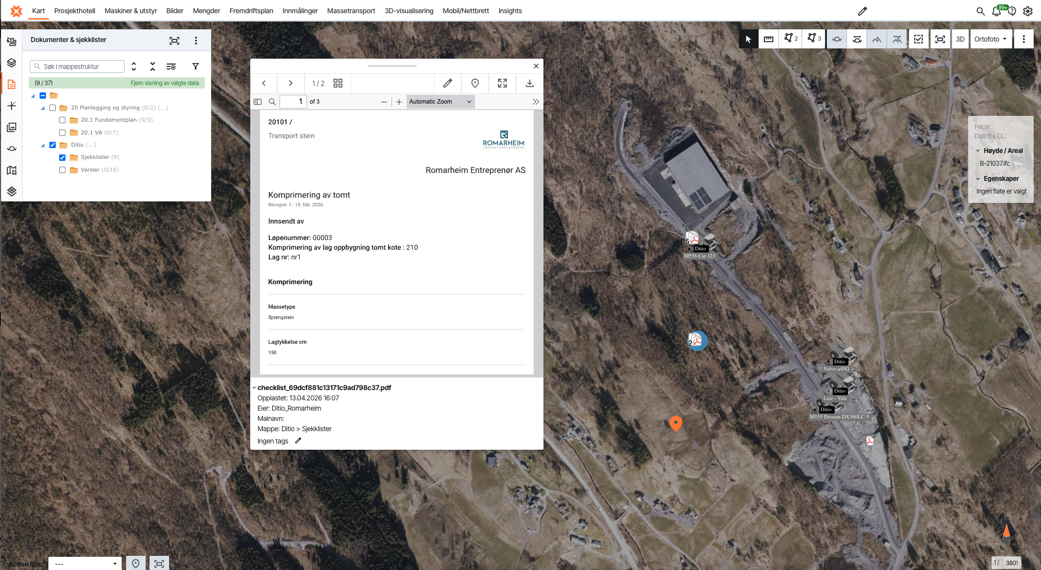
By integrating Ditio into this ecosystem, Infrakit customers gain access to the operational documentation closest to day-to-day production. Ditio captures working hours, resource usage, photos, checklists, non-conformance reports, production data, and other field information. When this data is connected to Infrakit’s models and map-based environment, teams gain a deeper understanding not only of where work is taking place, but also how, when, and why it is being carried out.
Together, Infrakit and Ditio provide project teams with a shared, real-time foundation for decision-making, improving coordination between planning and execution while reducing the risk of rework.
Visa Hokkanen emphasizes that Infrakit and Ditio are not competing systems—they are complementary solutions. While Infrakit provides model-based project control, mapping, machine control data, and visual project oversight, Ditio has established a strong position in mass haul logistics, workforce management, and timesheet reporting. Together, the two platforms provide a richer, more complete operational picture that enables more accurate, efficient, and predictable project delivery.
As Hokkanen puts it:
“We are super strong together.”
The value lies in the connection. Infrakit provides the precise, geospatial foundation for project control, while Ditio contributes the operational context from the field. Together, they give project managers something they have rarely had before: a single place where the digital model and on-site reality come together.
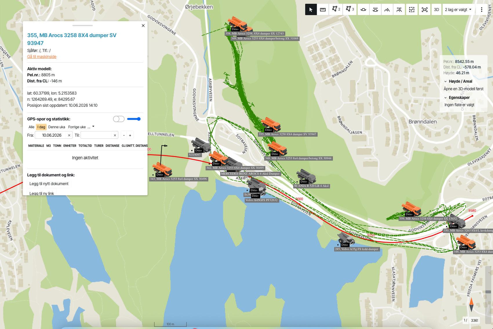
For site managers, this means critical project information is available in a format that is easy to use in day-to-day operations. Progress and quantities can be visualized directly on the map. The design model can be compared with actual data collected through drones or surveying. Project development can be monitored in real time, while production data can be more closely connected to mass haul operations and project workflows through Ditio Flow.
For Infrakit customers, the integration delivers greater situational awareness. Project progress and production can be visualized directly within the map interface, while supporting documentation remains linked to the relevant locations. This reduces the need for manual data consolidation, simplifies reporting, and provides a more accurate basis for informed decision-making.
Better Decisions While the Project Is Underway
Many of the most critical decisions in infrastructure projects are made during construction—not during planning. Minor issues can quickly escalate into costly delays if they are not identified early. By combining data from both Infrakit and Ditio, project teams gain a stronger foundation for identifying root causes, prioritizing corrective actions, and adjusting production before small issues become costly mistakes or require rework.
It’s not enough to know that progress is falling behind schedule—the real value lies in understanding why. Is the delay caused by ground conditions, resource allocation, machine availability, waiting time, design changes, or other operational factors? By connecting field documentation more closely to the digital model, project teams gain the context they need to manage projects more effectively, improve coordination across stakeholders, and reduce the risk of rework.
Hokkanen highlights that, together, the two systems drive higher performance and greater efficiency throughout project delivery. For project owners, contractors, and site managers, this translates into better analysis, more informed decision-making, and more predictable project execution. With a real-time view of both the digital model and actual construction progress, teams can manage projects with greater precision while work is actively taking place on site.
Traceability That Simplifies Documentation and Project Closeout
Comprehensive documentation is essential in modern infrastructure projects. Photos, inspections, non-conformance reports, timesheets, and production data must be easy to trace, explain, and verify. When information captured in Ditio is linked to the relevant locations, assets, or activities within Infrakit, it creates a far more accurate and complete documentation record.
“With Ditio, our customers can capture quality data in a simple and efficient way, ensuring first-class project documentation,” explains Hokkanen.
Steffen Nerdal, Chief Commercial Officer (CCO) at Ditio AS, also sees clear value for customers of both companies:
“By visualizing Ditio data within the Infrakit platform, we are delivering a unique value proposition to the construction and infrastructure industry. We are already seeing strong interest across the Scandinavian market in the integration between Infrakit and Ditio.”
For customers, the benefits extend throughout the entire project lifecycle, but they are especially valuable during reporting, quality assurance, and project closeout. Discussions can increasingly be based on georeferenced, verifiable data rather than manual searches, uncertainty, or competing versions of the truth. This gives contractors, project owners, and project partners greater transparency, stronger collaboration, and improved project control.
Because the data is continuously updated, project teams also gain greater visibility into production progress, resource utilization, and material movement throughout the project. This creates a more reliable foundation for financial follow-up, supports smoother project closeout, and reduces the risk of misunderstandings during the later phases of project delivery.
A Sustainable Foundation for the Future of Project Delivery
The partnership between Infrakit and Ditio marks an important step toward a more data-driven, efficient, and transparent construction industry. The integration provides customers with an even stronger foundation for managing complex infrastructure projects with higher quality, lower risk, and improved profitability.
When real-time data flows seamlessly between the field and project management, teams can coordinate work more effectively, identify and address deviations earlier, and reduce the need for costly rework. The result is more efficient project execution, greater operational control, and more predictable delivery.
At the same time, the benefits extend beyond cost and schedule. Hokkanen also highlights the environmental impact of better data and more efficient project execution. When material haulage and earthworks are planned and monitored with greater precision, projects can reduce unnecessary transportation, equipment idling, and inefficient resource use.
This not only lowers costs but also reduces CO₂ emissions and supports more sustainable project delivery.
“Sustainability in construction is largely about avoiding rework and unnecessary transportation. When you have better real-time control over material movement and production, you improve not only profitability but also your environmental performance by reducing emissions.”
By combining model-based project management with real-time operational data, Infrakit and Ditio are helping the industry build smarter, more efficiently, and more sustainably. Together, they are laying the foundation for the next generation of digital infrastructure projects.