
GPS Grade Control: Accuracy, ROI & How It Works
Grade control cuts work phases from hours to minutes. But speed is only half the story: surveyors stop re-staking, quality checks happen in real-time, and as-built data generates itself.
Request a demo
How grade control actually works on infrastructure projects, what accuracy and ROI to realistically expect, and what to consider when choosing a system for your fleet.
The math on excavator grade control is simple. An experienced operator without GPS works to roughly ±5cm tolerance on a good day. With grade control, that drops to ±1-2cm—consistently, across every pass, regardless of operator experience.
On a 12-kilometer highway subgrade, that precision difference translates directly into material. Less over-excavation means less wasted aggregate. Fewer second passes mean fewer machine hours. And every cubic meter you don't have to haul away or bring back is money that stays in the project budget.
But accuracy is only part of the story. The real shift is what happens to the rest of your site operation when the excavator knows exactly where it is and where it needs to dig. Surveyors stop re-staking. Quality checks happen in real-time instead of after the fact. As-built data generates automatically instead of requiring someone to walk behind the machine with a rover.
This article breaks down how grade control actually works on infrastructure projects, what accuracy and ROI to realistically expect, and what to consider when choosing a system for your fleet.
How grade control works
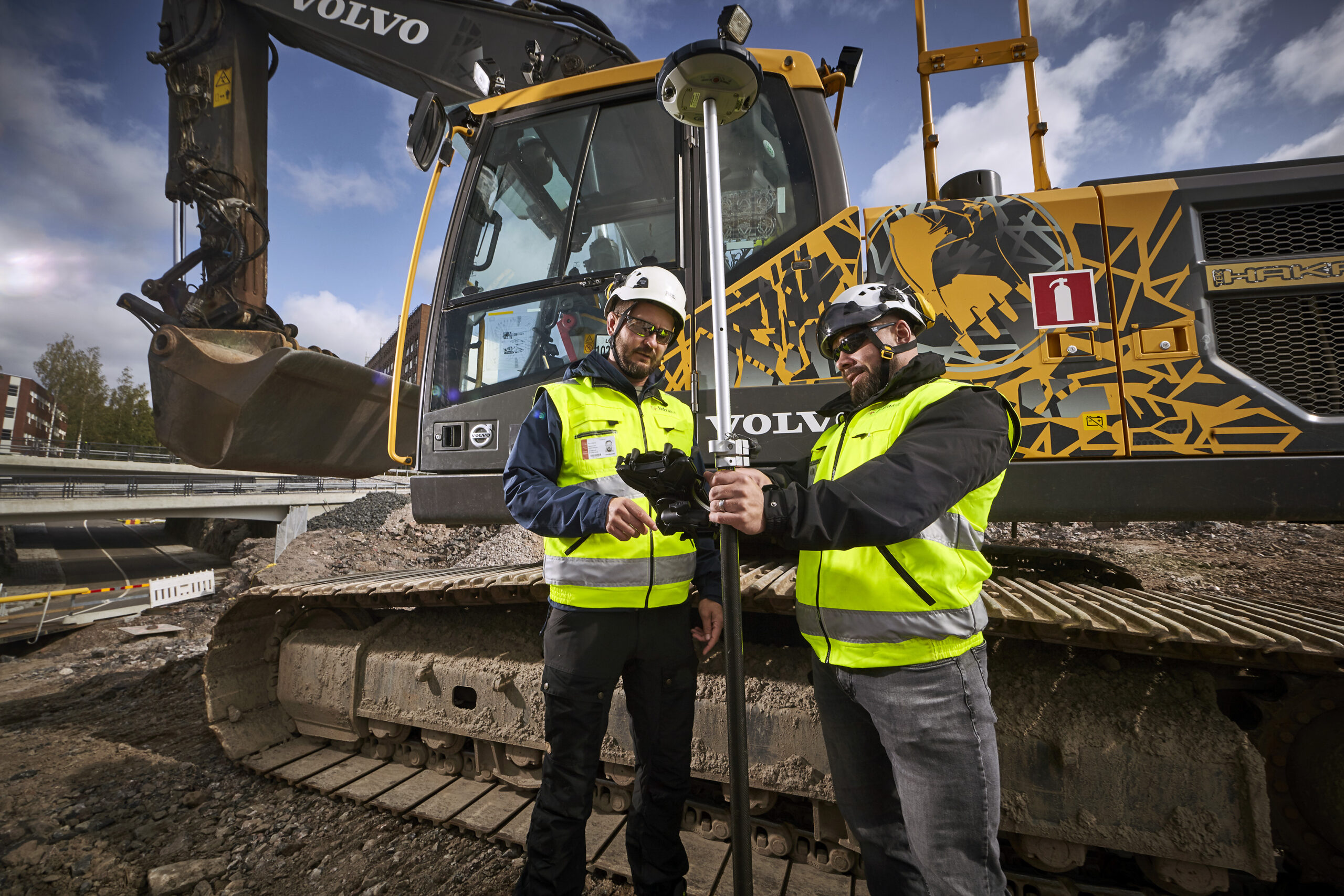
The concept is straightforward. Two GNSS receivers sit on the excavator—typically on the cab and boom—tracking the machine's exact position and orientation in three dimensions. An inertial measurement unit (IMU) handles the rapid movements that GPS alone can't keep up with: boom swing, arm extension, bucket curl. Together, they calculate where the bucket teeth are at any given moment, down to the centimeter.
A 3D design model loads onto the in-cab display. The operator sees a live cross-section showing current bucket position against the target surface. Too deep — the screen flags it. Too shallow — it shows exactly how much material remains. Right on design grade — confirmed instantly, no second-guessing.
On indicate systems, the operator adjusts based on what the screen shows. On automated systems, hydraulics take over — the bucket tracks the design surface automatically while the operator focuses on moving material efficiently.
The base station or network RTK connection is what makes this precise rather than approximate. Raw GPS gives you meter-level positioning. RTK correction brings that down to ±10-20mm. That's the difference between "somewhere near the right elevation" and "15mm from design grade."
What changes in practice goes beyond the bucket. The operator gains something that's hard to quantify but easy to recognize on site — independence.
That last part matters more than people think. Every time an operator stops digging to wait for a surveyor to confirm grade, or walks across the site to ask the foreman what's next — that's productive time gone. Grade control keeps the machine moving and the operator confident that what they're building matches what was designed.
"The excavator driver sees in real-time where and how things have been done and they are pretty excited about it. The drivers have access to more data and they can work more independently. There is no need to check, wonder and ask someone to show them what to do next."
Jari Kainuvaara BIM Manager · City of Espoo2D vs 3D excavator grade control
Not every job needs full 3D. The choice depends on what you're building.
2D excavator grade control works from a single reference — a laser transmitter on a tripod or a single GNSS receiver. The system controls one thing: depth or slope relative to a known benchmark. The excavator knows how deep the bucket is, but it doesn't know the full design surface underneath.
This works perfectly well for straightforward excavation where the target is a flat plane or a single slope. Utility trenches at consistent depth. Detention ponds. Foundation digs. The equipment is simpler, the setup is faster, and the investment is lower.
Where 2D runs into trouble: the moment the design surface starts changing in more than one direction. A highway subgrade through a curve transition where cross-slope shifts every 20 meters. A drainage channel where the invert follows a complex vertical alignment. An interchange where every section has a different target elevation. You can technically set a 2D system to follow a slope — but when that slope changes constantly, the operator is back to interpolating between reference points.
3D excavator grade control loads the complete design surface into the cab. The system knows the full terrain model — every curve, every slope transition, every superelevation change. The operator doesn't need to think about which grade applies at which station. The display shows it continuously.
The practical difference shows up in speed. With 2D, the operator digs to a reference, then the surveyor checks, then adjustments happen. With 3D, the operator digs to the surface the first time. No stopping, no checking between stations, no waiting for confirmation that the cross-slope transition is correct.
The visibility changes the dynamic entirely. With 2D, quality verification happens after the excavator moves on. With 3D, as-built data generates while the machine works — visible to everyone from site engineers to project managers. Problems show up immediately, not during a survey check the next morning.
So which do you need? A reasonable rule of thumb: if your design surface can be described in a single cross-section that doesn't change much, 2D handles it fine. If the surface varies continuously — which describes most road and highway work — 3D pays for itself in fewer passes and less rework.
For infrastructure contractors running mixed project types, many equip their fleet with 3D and simply use it in 2D mode when the job is straightforward. The hardware supports both. You're not choosing one forever — you're choosing a capability ceiling.
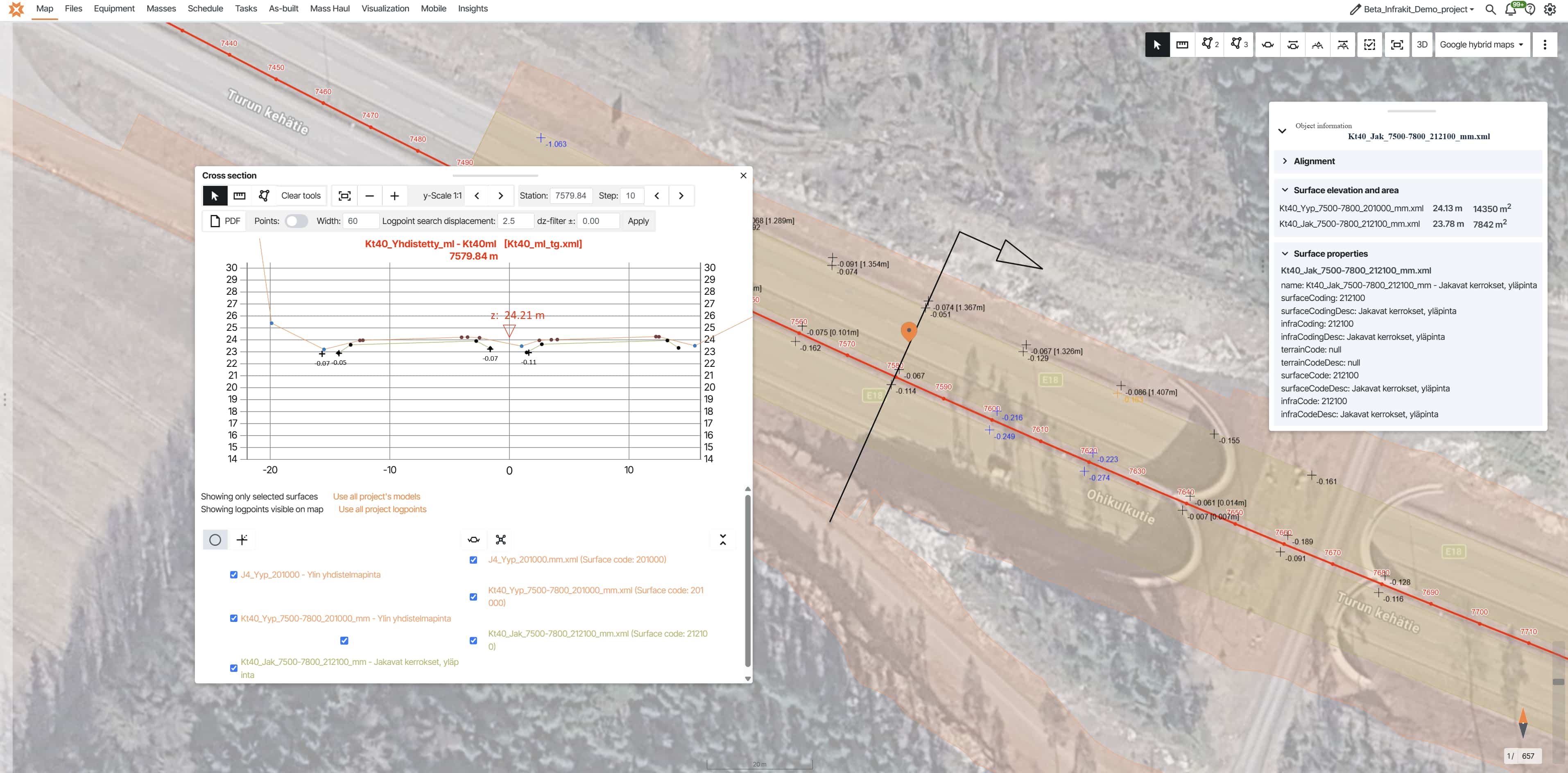
One thing worth considering early: whichever system you choose, the value multiplies when as-built data flows back automatically. A 3D system that guides the operator precisely but stores the results locally is only doing half the job. When that same system feeds as-built points into a shared project map in real-time — that's when site managers, quality teams, and project owners all start making better decisions without picking up the phone. See how Infrakit connects as-built data to one map →
What accuracy to expect on infrastructure projects
Spec sheets say ±10-20mm with RTK correction. On a real site with tree cover, bridge structures, deep cuts, and unstable network connections — expect ±15-25mm in elevation from a well-maintained system. That's still far tighter than the ±50mm that manual methods typically deliver.
The difference isn't just the number. It's the consistency. Manual excavation varies with operator experience, fatigue, and conditions. Grade control holds the same tolerance across every pass, every operator, every hour of the shift.
Most infrastructure specs require ±20-30mm on subgrade. Grade control meets that comfortably. For tighter work like asphalt base preparation at ±10mm, you may still need total station checks on critical sections — but those become spot verifications, not full surveys every 15 meters.
What affects accuracy in the field: satellite visibility (less open sky = less precision), unstable RTK signal, and normal wear on the machine over time. Regular calibration checks — covered later in this article — catch accuracy drift before it becomes a problem.
"Some of the drivers work within an accuracy of one centimetre. They want us to see that 'we've got this, we know how'."
Jussi Laamanen Quality Manager · YIT, E18 highway


Where the ROI comes from
Grade control pays for itself through several channels. Some are obvious, some only show up when you track time across a full project.
Material savings. Over-excavation is the silent budget killer on earthwork projects. Without grade control, operators dig past design depth as insurance — better too deep than too shallow, because adding material back costs more than removing extra. On a 12-kilometer highway subgrade, even 3-5cm average over-excavation means thousands of cubic meters that didn't need to move — and at €15-25 per cubic meter for excavation, haulage, and disposal, the numbers compound fast.
Grade control cuts over-excavation to near zero. The operator sees exactly where design grade is, so material stays in place or gets moved once — not twice.
Fewer passes. Without guidance, operators make a rough pass, then refine. Sometimes a third pass to get within tolerance. Each pass costs fuel, machine hours, and time. Grade control gets closer to final grade on the first pass. Second passes become touch-ups rather than corrections.
Reduced rework. A section that's excavated 8cm too deep needs backfill, compaction, and re-verification. That's not just material cost — it's schedule impact. Grade control catches deviations in real-time, while the bucket is still in the ground. Fix it now in seconds, not tomorrow in hours.
Terje Glad, BIM Manager at Veidekke, put it simply: "We avoid a lot of mistakes every day by being confident that the machines have the right basis."
Speed. This one surprises people. You'd think adding technology would slow operators down — more screens to watch, more systems to manage. The opposite happens. Operators work faster because they're not stopping to wait for grade checks, not second-guessing depth, not making conservative cuts to avoid over-excavation.
Jussi Laamanen quantified it on YIT's E18: "If one phase used to take two hours to be done previously, now it takes 30–45 minutes. It is a big difference."
That's not a marginal improvement. That's cutting task time by 60-75%. Across an entire highway project spanning years, those time savings reshape the schedule.
Surveyor reallocation. This might be the largest return that doesn't show up on a line item. When excavators work to grade autonomously, surveyors stop spending their days checking cuts and re-staking. They shift to higher-value work — design verification, as-built documentation, quality control coordination. You don't need fewer surveyors. You need the same surveyors doing work that actually moves the project forward.
The combined effect: projects like YIT's E18 and Veidekke's E6 report measurable improvements in schedule, material efficiency, and quality outcomes. Not because the technology is magic — but because it eliminates the gap between design intent and field execution that traditionally consumed time, material, and attention.
What your surveyors can do when staking disappears
The old workflow: set up the total station, walk the alignment, pound in stakes every 15-20 meters, write cut depths on each one. Come back two days later when half are destroyed. Repeat.
Jari Kainuvaara, BIM Manager at the City of Espoo: "Before Infrakit, we used wooden sticks: someone watched from the other side of the rod to a label, and then your co-worker would show where the new layer should be and should they dig something out — with the help of measuring tape."
When grade control takes over, that workflow disappears. But the surveyor doesn't. Their role shifts to higher-value work — verifying as-built conditions against design, monitoring quality data across the alignment, catching issues before they affect work.
On projects without grade control, surveyors get pulled into reactive work constantly — asked to perform small checks for foremen, dropping their planned tasks to answer questions that grade control would handle automatically.
Grade control breaks that cycle. The operator has the information in the cab. The foreman checks progress on a tablet. The surveyor focuses on quality — not interruptions.
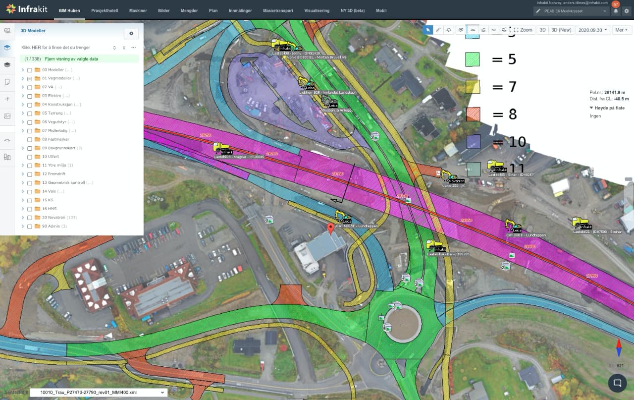
See grade control data from every machine on one real-time map
Design models out, as-built data back — automatically, across Trimble, Topcon, Leica and more. Your surveyors stop managing portals and start managing quality.
Managing grade control across mixed fleets
On most infrastructure projects, you don't get to choose one equipment brand. Your company runs Trimble. The sub brings Leica. Rentals come with Topcon or Novatron.
Suddenly you have five machines and four manufacturer portals — each needing the same model in a different format.
Without integration, your surveyor uploads the same model multiple times, checks multiple dashboards, and downloads as-built data from separate systems.
The operator in the cab doesn't notice the difference — they still use their familiar Trimble, Topcon, or Leica display. The difference is behind the scenes: one upload, automatic distribution, all as-built data in one place.
One excavator, one brand? The manufacturer portal works fine. Ten machines, four brands, three subcontractors? You need a single point of control.
See how contractors connect Trimble, Topcon, Leica, and other brands into one platform for managing all machine control systems →
"Instead of going through five different portals, it now sticks with one. Overall, this provides much more efficient machine control."
Eirik Frimannslund Survey Manager · PEABCalibration and quality assurance
Grade control accuracy drifts over time. Normal machine wear, sensor shifts, operating conditions — if nobody checks, the system still shows green on the display while the bucket is 4cm off target.
The fix is simple: measure a known control point with the machine, compare against the surveyed position. Most contractors do this weekly or at the start of each work phase.
PEAB automated this on their E6 project: "Infrakit has a function that semi-automatically checks the accuracy of the shovel. All the machine has to do is measure a known point. Then Infrakit saves the history and gives a warning if it is outside the accuracy requirement."
That history is where the real value sits. Not just "is it accurate today" — but trending over time. Which machines drift fastest? Is there a pattern? You catch problems before they affect work, not after.
Jan Steinar Stein at Veidekke: "We automatically receive geometric controls done by the machine operators, who code the points correctly and measure in the correct layer of the model."
This is where grade control becomes more than a productivity tool.
The excavator isn't just digging to grade — it's proving it dug to grade, with traceable data that holds up during quality audits and warranty discussions years later. For buried work that can't be re-inspected without excavation, this automatic record is your only proof of what's under there.
For the complete picture, pair machine-generated as-built data with GPS-tagged field reporting and photo documentation — your proof of what's under there when excavation is no longer an option.
Getting started on your next project
Evaluating excavator grade control for your fleet? Five questions worth answering before the equipment decision:
What type of work dominates your projects? Flat excavation works fine with 2D. Variable surfaces — road subgrades, drainage channels, complex earthwork — need 3D. Most infrastructure contractors find 3D covers everything, while 2D limits them on their most valuable projects.
How many equipment brands will you manage? One brand, one portal — simple. Multiple brands from subs and rentals — you need an integration layer, or your surveyor becomes a portal manager. Think about your typical project, not your simplest one.
What accuracy do your specifications require? GPS grade control consistently delivers ±15-25mm on infrastructure. For work tighter than ±10mm, plan total station verification on those sections.
Where does the as-built data go? If it stays on the machine or in a manufacturer portal, you're capturing accuracy but not visibility. In a shared project platform, everyone — site managers, quality teams, owners — sees real-time progress without requesting reports.
How will you handle calibration? Weekly manual checks work but leave gaps. Automated tracking with historical trending catches drift earlier — and builds a quality record that survives audits.
The technology itself is proven. Thousands of excavators run grade control daily across Europe. The question isn't whether it works — it's how well you integrate it, so the accuracy, time savings, and quality data reach the people who need them.
Twenty-two weeks. That's not a grade control number alone — that's machine control, design data, and project coordination connected into one workflow.The excavator is where it starts. The platform is what makes it scale.
"With model-based design we've saved about 22 weeks — so around six months of loose ends have been cut, which is also showing on the construction side as better efficiency."
Jarmo Niskanen Project Manager · Finnish Transport Infrastructure Agency, National Road 4Ready to see how excavator grade control integrates with your project workflow?
We'd be happy to show you how Infrakit connects grade control data from Trimble, Topcon, Leica, and other systems into one real-time project map.
Frequently asked questions | What accuracy does GPS excavator grade control achieve? Do operators need extensive training? Does grade control work on mini excavators? What happens when the RTK signal drops? How often should calibration happen? Can as-built data from grade control replace traditional survey verification? What's the typical payback period? |