Infrakit and Initial Information Models
Carefully gathered and applicable initial data models is the cornerstone of infrastructure projects
Initial data that is both solid and usable is the precondition for a project to succeed within budgeted costs. Poor-quality initial data lead to poor-quality designs and from there to additional costs and delays in schedule in the construction phase.
The Finnish National InfraBIM Requirements 2015 part 3: “Requirements on Initial Information” is about gathering and harmonizing initial data into an easy-to-access digital material: initial information model. The guidelines describe the best practices related to the initial information model, but it also leaves room to implement it with various software solutions.
The raw material for the model is procured through multiple sources, for example: different registries and terrain measurements. The raw material is handled and then formed into the model by harmonizing the material into open formats and to the modern coordinate system (typically ETRS in Europe).
Example harmonizing the material:
A single InfraModel3 mesh model is transformed from a 2D map of water maintenance material (built from multiple DWG files) — National InfraBIM guidelines 2015
Finally the harmonized material – initial infomation model – consists of a group of open format files, which portray the desired area clearly for the design phase. At the moment the most used open format file types in Finland are InfraModel3/LandXML, GT file, DWG/DXF and IFC. As an addition to the model files itself, a model description in text form (Word or PDF) is linked to the initial information model, which reports the accuracy of the initial data and executed editing procedures.
Utilizing Infrakit
The best way to gather initial data and constructing the initial information model is to use Infrakit. Initial data model is gathered, which includes the 3D material and the required reports in folder structure approved by InfraBIM guidelines. On Infrakit the model is easy to view on map and 3D display. The designer in the next phase can download it on his computer as a whole or file-by-file to be used in any design program.
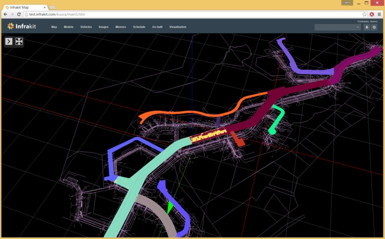
3D view on Infrakit.
Infrakit manages harmonized material checking. For example the success of coordinate conversions can be visually checked. You can also check that the material is successfully transcribed into an open format file type from the original design system. With Infrakit the designer or the project owner can verify the initial information model quality assurance. For the project owner the finalized model is easy to procure and validate as well as easily applicable in the next phase.
You can read my previous post about the InfraBIM guidelines here.
Book a Demo
Discover how Infrakit connects your entire infra project operations and drives value to every part of your business.
Recent Comments