A joint article by Infrakit and Invera / Gemini Terrain
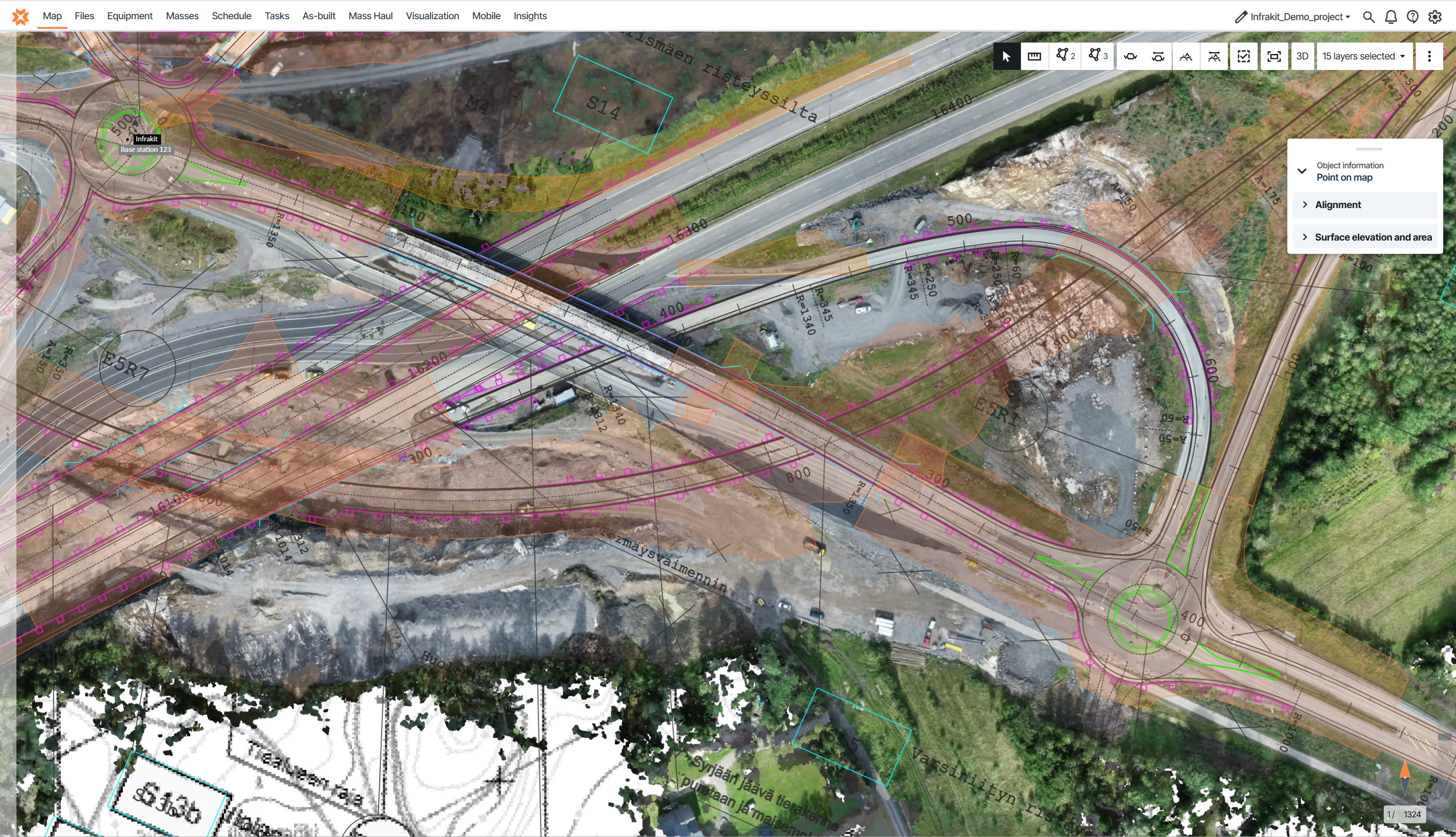
Modern infrastructure projects in Norway generate orthophotos at an industrial scale.
A single highway or railway corridor can produce hundreds of high-resolution orthophotos and terabytes of imagery throughout construction—captured weekly, and in some phases even daily. Keeping this imagery up to date across project teams can be challenging.
The integration between Infrakit and Gemini Terrain makes one important part of that workflow simpler. Instead of manually importing updated orthophotos into Gemini Terrain whenever new drone imagery is available, surveyors can access the latest imagery directly from Infrakit through a WMTS connection.
The challenge with managing orthophotos
Gemini Terrain is where Norwegian surveyors and civil engineers perform some of their most demanding work—preparing survey data, modifying designs, converting coordinate systems and producing outputs that feed directly into construction.
Its local-first architecture gives users full control over large and complex datasets, making it a trusted tool on road and rail infrastructure projects.
At the same time, orthophotos have become much more than a survey deliverable. They are used for visual documentation, progress monitoring, as-built verification, invoicing and collaboration across the entire project organisation.
When new orthophotos are produced frequently throughout construction, keeping everyone working from the latest imagery can become a challenge.
A simpler workflow: from drone to Gemini Terrain
The integration between Infrakit and Gemini Terrain builds on a workflow survey teams already know.
- The drone team uploads processed orthophotos into Infrakit.
- Infrakit publishes the imagery through a WMTS service.
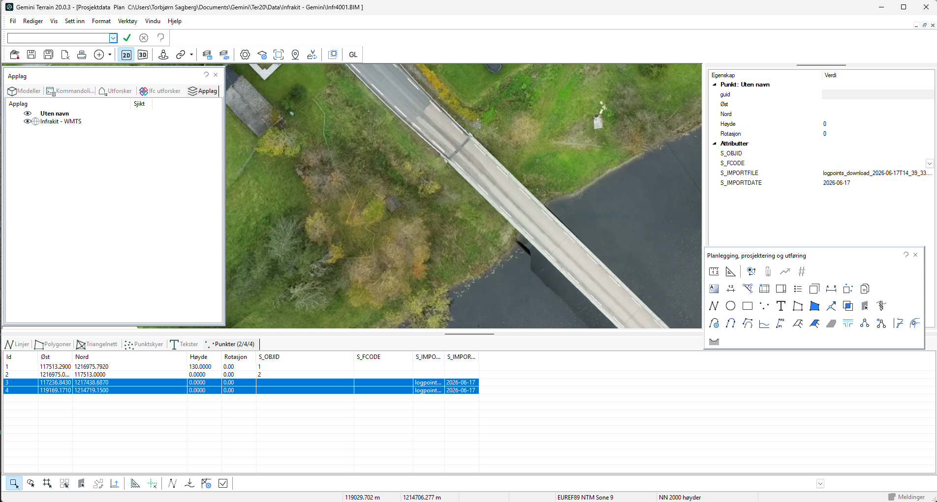
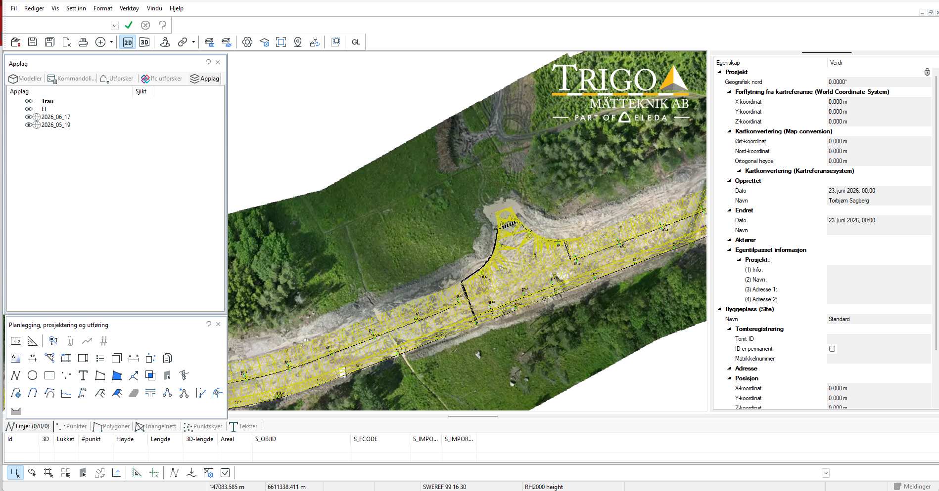
- The surveyor adds the WMTS connection in Gemini Terrain.
- The latest orthophotos become available as a background layer for modelling and design work.
Instead of repeatedly importing updated orthophotos into Gemini Terrain, surveyors can access the latest imagery directly through the WMTS connection. This provides a simpler way to keep orthophotos current while reducing the need to manage large image files locally.
Whether a project contains one orthophoto or hundreds, surveyors always connect to the same source.
Compare your designdata with newest Ortophoto – live from Infrakit
What this unlocks in practice
Keeping orthophotos updated in Infrakit benefits more than the survey team.
The same imagery used in Gemini Terrain for modelling and verification is also available in Infrakit for site teams, project managers, contractors, machine control workflows and asset owners.
Everyone works from the same current imagery, making it easier to review construction progress, compare as-built work, support invoicing and collaborate across disciplines.
For surveyors, the benefit is straightforward: access to the latest orthophotos directly within their preferred design environment.
“Our workflow starts with uploading drone imagery to Infrakit. From there, we simply use the WMTS link directly in Gemini Terrain whenever needed. It provides a simpler way of working with orthophotos and gives us easy access to the latest imagery.”
— Ann-Christin E. Bryne, Project Engineer, Stangeland
Why we built this integration
Infrakit is not designed to replace Gemini Terrain.
Gemini Terrain remains where surveyors carry out advanced modelling and production work.
What Infrakit adds is connectivity—linking field data, survey workflows and the wider project organisation. The orthophoto integration is a practical example of this approach.
Surveyors continue working in the environment they already trust while accessing up-to-date orthophotos directly from Infrakit. At the same time, the same imagery is available across the wider project, creating better visibility and collaboration between the office and the construction site.
Each solution focuses on what it does best while working together as part of a connected digital workflow.
“Our mission is to connect the tools our customers use every day, making infrastructure projects more efficient and improving day-to-day work for project teams. We’re excited to partner with Volue to make it easier for surveyors to keep using Gemini Terrain while seamlessly connecting their work with the rest of the project.”
— Teemu Kivimäki, CEO, Infrakit
“Open integrations allow our customers to preserve the workflows they already trust while strengthening collaboration across the wider project ecosystem. Our partnership with Infrakit is a great example of how Gemini Terrain can integrate with complementary solutions to create greater value for surveyors, contractors and infrastructure owners alike.”
— Adam Berg, CFO, Invera AS / Gemini Terrain
Get started
If you already use Gemini Terrain and Infrakit, connecting orthophotos through WMTS takes only a few minutes.
Follow our step-by-step guide:
How to add Infrakit WMTS orthophotos to Gemini Terrain
If you would like to see the workflow in practice—from drone capture to modelling and project collaboration—we would be happy to show you.