Changes in the infrastructure industry – Expert interviews: Tim Barry

Changes in the infrastructure industry – Expert interviews: Tim Barry

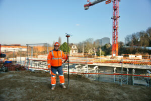
Tim Barry is an infrastructure specialist with over 20 years of international experience working and consulting in environmental infrastructure, in private and public utilities and for EPCM contractors. Currently, he works as an Interface Manager at Watercare, encouraging outcome focused engagement with other major projects in Auckland. In our conversation with him, we discussed how the industry has changed and developed in the last decade and what challenges it might face in the future.

Background and experience in the industry

I’ve been in this industry or related fields since graduating in the 1990’s and I’ve been back in New Zealand for seven years, in that time overseas I’ve been based in the UK, the People’s Republic of China and Australia.

My first start on the Anglian Water graduate program came from a New Zealand water resources paper I submitted as an undergraduate to a joint IPENZ / Anglian Water award and was awarded a placement on the 3-year graduate program of the privatized UK utility. This was a great start for understanding the sector as the program emphasized a broad experience platform moving us around various business placements, some of which were unique for an engineer. I maintain a close association with Anglian Water, even spending a week with them last year.

On completion of the program, I moved with Anglian’s international division to Beijing, China where we were looking to expand our non-regulated businesses. There, business accelerated, and I worked on the world’s largest water industry tender, which we eventually won and pursued utility acquisitions in over 10 provinces. After several years I switched to Shanghai and the ultra-competitive EPC market serving the world’s largest industrial workshop in the Yangtze delta. We served foreign owned industrial customers providing bespoke water and wastewater systems. I managed a full EPC team of about 40 delivering about 10 diverse projects annually. I took up an opportunity to move to Australia, also in EPC management and commercial roles.

Most of my experience has been in the industrial or municipal water systems. The last seven years with Watercare has transitioned from complex process-based projects to front ending large linear transmission ones, it’s been great for adding that experience.

The biggest changes in the civil work and infrastructure industries in the last decade

Probably the biggest difference is the fourth industrial revolution. The fact that data and digital technology is now a thing. That’s got to be one of the biggest ones, also now we’re carbon focused. We’re trying to be sustainable, and we’re trying to chop the emitted carbon out of what we’re building and operating.

With respect to digital technology. We’re looking to benefit from generated data for the entire life of our assets, so basically having a relatively up-to-date live model, ultimately a “digital twin” of the hi-touch, critical assets and maintaining that digital relationship with those critical assets for their working life.

Typically, the bulk of our work and services are pipes and squeezing another ten, twenty or thirty years out of the life cycle would be huge for the balance sheet and a change for the business overall. We’ve got tens of thousands of kilometers of pipes. So, data is important. Carbon goals are also empowering our employees to act on initiatives.

Health and safety have improved as well. Particularly in New Zealand where historically it has lagged compared to other similar countries. For example, my experience with Anglian Water in the late 90s. They were already relatively advanced.

Making carbon a priority

What we have with carbon is a three-pronged approach that’s working well.

Firstly, we have a sustainability strategy, that’s been embedded for over a year now at Watercare. It states very clearly what our purposes are, our responsibilities to the living environment and how we go about engaging with our decision process. This sets the scene.

Secondly, we have our 40/20/20 targets, so we have something to aim for. This is a 40% reduction in built carbon. A 20% reduction in costs, and a 20% year-on-year improvement in safety and wellbeing by 2024, all set against baseline 2018 metrics.

The third prong is how we’re engaging our supply chain for longer-term delivery of assets, where we’ve developed what we call the ‘enterprise model’, which is unique in New Zealand. It’s a capital pipeline of two and a half billion dollars’ worth of work for the next decade, awarded to a set of contractors. Engaged for the duration as partners, they can help us deliver the 40/20/20 targets by being more strategic and engaged with the sustainability strategy.

An example of this is concrete suppliers. Concrete is our largest carbon input by some margin. Yet we have never had a close relationship with the producers, and they would not embody our goals. Instead, like most other large clients we’ve always engaged a contractor who have gone with the lowest cost on concrete. Now, through the enterprise model we engage directly to the ‘shop floor ‘of those vendors to align our strategy and goals. That’s something we’ve never been able to do, and this holds a huge potential. We are targeting a 60% reduction in carbon.

Global exemplars in carbon reduction demonstrate that the largest gains are found through reducing the degrees of separation with their value chain. And the cohesive strength of everyone working towards the same goals.

Also important is setting transformational goals. A 10% improvement is easy to achieve and doesn’t necessarily prompt any real change, but a 40% change forces you to totally rethink things, retool and transform the business.

We also benefited from Anglian Water who set their carbon targets in 2010, so we benefit from a decade of experience. So, it’s not as if we’re doing some of these things for the first time. We get to look around the world and see what we can adapt effectively to the New Zealand situation. We’re different, we’ve got a different environment, different geography, systems, but there’s a lot in common that we can pick up.

That’s how we’re looking to make some easy, early wins on carbon in the next few years. In the longer-term it will probably be a case of diminishing returns. We’ll have to get far more granular.

“We won’t be looking at concrete, we’ll be looking at building practices, right down to some of the technologies that Infrakit offer.”

Biggest changes when considering the digital revolution, the carbon footprint and sustainability

A lot of our biggest changes in the future will revolve around customers and our relationship with them. What structured information does is it provides a more accessible stream of knowledge, that’s traditionally only available for limited people. That information can now be shared and viewed by the public so that with this drought that Auckland has been suffering from, we are able to engage our customers much closer than in the past. They are better informed than ever.

An example is the webpage illustrating our dam levels, which has traditionally been ‘unknowable’ information. So, the general public has not had this insight, but now if I go to my neighbors, they are quoting me the consolidated storage percentage. They never would’ve known this information before.

That’s just an example of how the public can be much more informed now. It also demonstrates the importance of credibility and trust, so we must share information whether it’s good, bad, or ugly or even if it reflects imperfectly on us because if we don’t, we will lose the confidence of our customers. And without that, the ability to drive other critical or controversial decisions, that would be a problem and a risk to a utility. Trust is needed for the hard calls.

In the past we’ve made decisions that have generally been sound, but behind closed doors by a collection of engineers and managers. That’s not going to happen exactly like that in the future, so I think that’s a major change. We need to have those relationships and discussions with our community, as the data is there for others to see.

The biggest change in the next 15 to 20 years is encompassing the need to convince people on a wider level than we’ve had to before.

Information flow to the public and vice versa

I think the idea of a fully functioning digital twin, is still a long way off. The fact that information is flowing, and it needs to certain areas is that you’re not going to be able to control it. There’s certain value in learning what you’ve shared, it’s cost effective too. People will have extra information, it’s an important relationship.

“Trust is the currency of the future.”

I know there isn’t a meter for trust but if there was then that’s what the leaders of the future would be interested in keeping an eye on. If you don’t have trust, then what do you have?

Damyanti Rathore
January 8, 2021

Book a Demo

Discover how Infrakit connects your entire infra project operations and drives value to every part of your business.

Infrakit project Tampere light rail nearing completion – 26 million euros below original budget

Infrakit project Tampere light rail nearing completion – 26 million euros below original budget

The first phase of Tampere Tram project is now 90 percent complete and the savings are estimated to be up to 26 million euros. Over three and a half years, the tramway tracks have been built faster than planned. Construction for the first phase started in spring 2017 and traffic is set to start in 2021.

According to Sari Valjus, the project manager of the Tram Alliance, on Kauppalehti article 17/10/2020, the moment is historic as rail works – the most important work phase of the project’s first part, is now completed. Read the whole article on Kauppalehti in Finnish here.

Infrakit was used on the project. Check our reference article of the project here.

For more information, contact:
Teemu Kivimäki, CEO and Founder
teemu.kivimaki@infrakit.com
+358 50 344 6465

Linda Hakala
December 2, 2020

Book a Demo

Discover how Infrakit connects your entire infra project operations and drives value to every part of your business.

Compatibility and independence form the basis for success

Compatibility and independence form the basis for success

For many parties in the GWW, Infrakit has become a very important tool. But what exactly gives Infrakit the ‘X-factor’? We talked to Tiny Nuiten, Managing Director at Infrakit, to try to find out what exactly this X-factor is.

When we look at Infrakit, the first thing that stands out is it independence from brands and other platforms, Nuiten says. We’re not limited to one specific brand. Machine-controlled or a measuring app? Just connect it. That’s also true about other data, such as documents, reports and pictures: Infrakit is compatible with all kinds of data and accepts practically everything.

‘Stick to what you know’

At Infrakit, our principle is: ‘Stick to what you know’. Nuiten: “We don’t go on any experimental diversions. We deliberately choose to do what we do extremely well. What we lack in-house, we source from other specialists. It goes without saying that we go about this with care, we don’t contract just any company. After all, we want to be able to guarantee quality across the board.

Infrakit ensures that hardware manufacturers are able to work together. This also applies for other data processors, such as Microsoft, Viktor, Relatics or Autodesk. “So we’re always looking to connect with specialists that share a common ground with what we do and have a similar objective. We establish partnerships and our clients validate the entire process. Our major clients are constantly working on the digitization process and looking for ‘the right tools for the right job’. One of those tools is Infrakit. We connect all the other tools they use and therefore play a pivotal role in the digitization process”. Nuiten refers to Relatics as a case in point: “Our customers use it and want to test information, that’s the reason for integrating with Relatics.”

Infrakit is a “gateway” in and out of BIM.

Independence as a priority

Infrakit believes that its independence is paramount. “We can’t just opt for one connection. We want to work on an open basis. Infrakit has become a central access point for Building Information Data. Whether it’s about that one particular model, drawing, picture or document, Infrakit allows you to centralize things at the front of the chain and make it available to everyone”.

In our experience, once you start digitizing, you quickly get a taste for it. Nuiten agrees with that. “Yes, digitizing makes you want more. It starts with one thing and then the wish list quickly expands. The great thing about Infrakit is that it’s prepared for this expansion. Infrakit is your guide that will take you through all stages of the process. That’s business optimization at its best. Everyone can contribute and share their information with all those involved.

Also for project owners and commissioning parties

An additional, not insignificant factor, is the fact that project owners and commissioners are becoming increasingly interested in Infrakit. “That makes sense, because it allows you to monitor the process, confident that everything is always in real time and up to date. Some government agencies even include Infrakit in their specifications. Did you know that Infrakit is a perfect tool for managing the entire tendering process? By continuously working with Infrakit from the moment the tender is placed, you’ll be able to use Infrakit during the maintenance stage. So from preparation, execution, and delivery to maintenance you’ll have all your data centralized and up to date.

Easy access to BIM

Infrakit is a so-called ‘Single Point of Truth’. “A central point for accessing real-time data. Once something is in Infrakit, it will speak the same language across the board, making Infrakit a gateway in and out of BIM. It doesn’t get any easier than that to access data in BIM. “Finally, another good example. Through recent experience, our clients have found out that by using Infrakit on an overall basis, it’s possible to achieve savings ranging from 10 to 20% of the project budget. This is not an estimate, but actual experience. That’s when you understand how important Infrakit can be.”

‘We are not limited to one specific brand’.

Infrakit is compatible with all forms of data.

Tiny Nuiten
November 26, 2020

Book a Demo

Discover how Infrakit connects your entire infra project operations and drives value to every part of your business.

Infrakit: the data-sharing solution that revolutionizes infrastructure construction sites

Infrakit: the data-sharing solution that revolutionizes infrastructure construction sites

Infrakit: a high-performance data-sharing solution at the Paris Line 11 site

Regarding the extension project for metro line 11 in Paris, Anthony Balbeurre, foreman at Bouygues Construction, is able to rely on a new tool to collect and share data in real time: Infrakit. Developed in Finland (where it is used on most infrastructure construction sites), Infrakit makes it possible to collect data on-site and exchange all data necessary for the project to run smoothly.

A shared data management solution

Infrakit’s promise is simple: to allow everyone involved at a construction site to easily exchange, in real time, all data necessary for the design, progress and successful delivery of the project. Infrakit relies on several key principles: format interoperability and cloud storage. With its powerful, universal online plan and data viewer, Infrakit makes fully digitalized site management possible, both intuitively and quickly.

In practical terms, Infrakit can be installed on many devices (tablets, mobile phones, laptops or desktop computers) and allows all stakeholders at a site to enter data (aerial or land photos, topographical surveys, proofing data, figures, notes , plans, etc.) on the project documentation. Once entered, the data is shared in real time with all stakeholders, via cloud storage. In terms of compatibility, Infrakit can be used with all the main hardware and software solutions in the industry: Bentley, Autodesk, Trimble, Novatron, Leica, Topcon, and many other CAD or site tracking software.

An appropriate tool for all phases of the project

One of Infrakit’s strengths is that it can be used from the design phase of the project until its final delivery. During the design and preparation phase, Infrakit brings together 3D plans and models from all the draft designers in the same place, so that they can be viewed, combined and checked for possible errors before arriving on site.

During the construction phase, at the Line 11 site, Anthony Balbeurre was able to use Infrakit in combination with a surveying antenna (equipped with an on-board GPS), which allowed him to measure extremely precisely (2 cm accuracy) the work carried out by the machines in the field. Thanks to this centimeter-level precision, he was able to carry out inspections on the work as he progressed, after completing the earthwork or pouring concrete, without having to bring a surveyor/topographer to the site.

Having this GNSS antenna (a Septentrio Altus NR-3 in this case, but Infrakit also works with other brands) and Infrakit makes it possible for these reception and control surveys to be performed as the work progresses independently. Once these readings are validated to match the design outlines, the work can continue without delay. Before using Infrakit, the foreman had to complete these surveys using another (unconnected) device and then, at the end of the day, take the time to extract the collected data and pass it on to other stakeholders like the head surveyor. Thanks to the interoperability of the GNSS antenna that they use now, in combination with Infrakit, the transmission of the data happens simultaneously with their input.

Infrakit thereby offers significant on-site time savings, even if the acceptance phase (which is an inevitable contractual validation) must still be carried out by a surveyor, who operates with his/her own tools (but, who nevertheless uses Infrakit to update his/her data with the rest of the teams).

Crucial assistance for site managers

Anthony Balbeurre, in charge of earthwork for the extension of metro line 11 clearly explains, “Infrakit helps me get all of the coordinates and designs in real time at my site and, most importantly, I can react immediately, without having to bring a surveyor out to the field. At the beginning of earthwork, I use Infrakit to locate my dirt entrances, as well as my ridges and embankments. During earthworks, Infrakit allows me to know exactly where I am, for example as it relates to altimetry. I can verify that we are in the right place and that we have not ‘eaten up’ the slopes too much, or, to the contrary, left too much material on them.”

For Anthony Balbeurre, being able to do without the daily visit of a surveyor, thanks to Infrakit, is an invaluable time-saver. He explains further, “I don’t have to bring the surveyor in all the way or wait for his information to move forward. For example, if I want to implant a sole (concrete bridge foot), thanks to Infrakit, the surveyor can communicate the file directly to me and, in just a few minutes, I get the information and I can go out into the field with my own GNSS antenna.”

Saving time, making work easier, fluid communication and real-time sharing of large amounts of data in a completely interoperable way: it’s no surprise that Anthony Balbeurre concludes by explaining that he recommends Infrakit, which he will use again in future projects.

Sebastien Cailliau
November 25, 2020

Book a Demo

Discover how Infrakit connects your entire infra project operations and drives value to every part of your business.

Building information models improve quality of construction

Building information models improve quality of construction

In infrastructure construction, information is increasingly being presented in the form of building information models (BIMs) rather than paper drawings. NRC Group uses BIMs in a variety of construction projects, significantly improving quality and productivity.

What is BIM?

Building Information Modelling or Building Information Models are known as ‘BIMs’ for short. In the infrastructure sector in general, BIM refers to a process spanning the lifecycle of infrastructure, and to management of the resulting information in digital format. BIM is also a way of working that emphasizes centralized information management, collaboration between actors, and visual modelling.

In practice, this can be seen in the increasing numbers of Finnish Transport Infrastructure Agency projects being completed — from planning to implementation — on the basis of BIMs. A good example of such a project is the improvement of the Pasila–Riihimäki track, in which the customer has reported savings of up to millions of euros with the help of BIMs: building information modelling provides a more accurate picture of what is being done and enables smart planning of work phases between multiple actors.

“Different programs can be used to visualize and analyze plans presented as building information models. Such models provide key information that can be used in the planning, implementation and reporting of a construction project,” says Jussi Heikkilä, BIM Production Manager. Heikkilä is responsible for the development and implementation of BIM-based construction at NRC Group Finland.

The right things in the right place at the right time

“BIMs provide a more detailed picture and calculations during the bidding and planning phases. With a mobile device, BIMs and other digital material can also be used during familiarization with sites in the field,” Heikkilä explains.

During the implementation phase, BIMs are primarily used for machine control (a feature of BIM-based construction) when creating earthworks. NRC uses this approach for all major projects. With the Infrakit tool, supervisors can monitor in real time what machine-controlled machinery is doing, and supervise the quality of work in relation to the plans. If the plans change, the machinery can be quickly updated accordingly. A faster response reduces construction delays and improves resource allocation: machinery utilization rates have increased as a result of BIM-based construction.

In fact, BIM has clear connections with the lean philosophy and goal of continuous improvement.

“BIM enables the realization of lean principles and continuous improvement in practice. It eliminates delays, waiting time and waste. It also makes work safer and more meaningful, as building information models provide better and more accurate plans for construction work. This means fewer surprises and conflicts between plans, and the implementation of projects as intended. So the right things are done in the right place at the right time.”

Effective information management

Building information models have been used in a number of ways at NRC Group, for example in the Mansikkakoski bridge project in Imatra, involving the construction of a new railway bridge over the Vuoksi river. BIMs have been used to check space reservations and ensure that a new bridge can be built across the Vuoksi as proposed by the designer. A combined model was used to ensure that the structures are compatible, and for clash detection.

“The overall project is much easier to visualize with a combined model, which facilitates the planning of work,” says Tiina Frilander, BIM Operator.

Picture: Finnish Transport Infrastructure Agency’s Mansikkakoski project/combined model of building plan
BIMs have also been used from the very start of the Kototolahti yard track extension project. Almost all construction — from cable routes to implementation of the track ballast layer — has been carried out on the basis of machine control models.

“Even during installation of track markings, done as additional work during the contract, we used machine control and the Infrakit application as a tool to ensure successful and precise installation,” says Samu Simonen, Project Manager.

Infrakit is the main tool used for BIM-based construction in both the Kotolahti and Mansikkakoski projects.

“BIM material and other construction data with coordinate information were exported to the Infrakit system during the Mansikkakoski project. Machine-controlled machinery, into which the BIM and construction material were wirelessly installed, was also connected to the system,” Frilander explains.

Information management is markedly eased by Infrakit, which enables the import of various documents and plans into the same tool. For example, Infrakit can be used to connect terrain photographs directly to the correct locations, easing overall project management. 360-degree panoramas and aerial photographs taken with drones were introduced last year. Drone images have been taken at different stages of the Kotolahti and Mansikkakoski projects, enabling easy monitoring and reporting of progress.

“Imaging material has also been used for the planning of work stages. The situation on the ground can be perceived in much more detail from a bird’s eye view,” says Simonen.

A drone orthophoto of the Mansikkakoski project

BIM-based construction has increasingly been used in non-construction work where, instead of three-dimensional BIMs, the most usable options are point cloud data concerning objects to be built or installed, or location-based digital project maps. In electrical construction projects, both supervisors and installation engineers use the Infrakit application, in which location-based project maps created using different technologies help supervisors to understand what is being built and ensure the feasibility of plans. At best, on a construction site installation engineers can use a mobile device with a separate GNSS receiver to view equipment installation locations with centimeter precision, without marking or measuring the terrain. The locations of installed structures can be documented immediately to enable the monitoring of progress and for the handover material.

Support for quality assurance

Continuous documentation of the progress of projects is also useful after their completion, since handover material is increasingly being provided to customers in digital format. Handover material is used to verify the quality of construction. Digital material is also easier to transfer to different systems, where information needed for care and maintenance needs in relation to construction projects can be found and used years later.

“The imagination is the only limit to the possible applications of BIM. Information management is the core around which everything else forms,” sums up Heikkilä.

This article was originally published on NRC group’s website in Finnish. View the original article here.

Linda Hakala
November 10, 2020

Book a Demo

Discover how Infrakit connects your entire infra project operations and drives value to every part of your business.