We serve you the secret for Michelin Star Menu: Infrakit release 3.9.1

We serve you the secret for Chef’s Special Menu: Infrakit release 3.9.1

Right from the first step into the restaurant, you can feel it, you can smell it: The Menu of this season is crafted with incomparable attention to detail, making the whole experience feel rich and effortlessly smooth.

Now we know building infrastructure and managing projects certainly does not always feel like running a Michelin Restaurant, rather more like preparing those smashed potatoes with too little salt and some overcooked vegetables… But that does not mean, the recipe of everyday meals could not be enhanced with some senior chef’s guidance, to make it more manageable!

That is precisely why we wanted to polish the everyday recipe and toolset of using Infrakit, to pursue our long-lasting vision of being the best cloud platform for infra projects, which in its essence, will become a reality only by you, the everyday chef using Infrakit for cooking, enjoying the experience and getting stuff done without everything being such a pain in the…

But what does the menu look like, and what tools to use to make it? Should we have a look?

Starters: The Soup of Simplicity

Starters never have to be shiny, but what they need to do, is bring an appetite and show that the restaurant can handle its recipes, and carry its water so to speak.

For your restaurant, where we want to give you recipes and tools to become a Star Chef, we created some features to enhance the simplicity of use. These will not only make you sweat less when cooking with Infrakit but also appear like a consistent, always-delivering master of mystic arts.

Infrakit area tool update comes with snap-to-model and snap-to-right angles. It’s also possible to create a Truck area directly from the measure tool. Small, but effective.

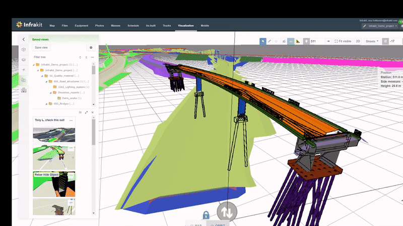
3D visualization has a new context menu that introduces « show model breaklines » and the possibility to render more vector data files in 3D (Survey formats like GT). More is more.

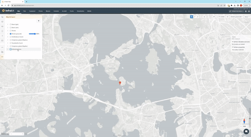
Map capture and export function comes with new options, you can hide stuff from it and update your company logo there from the organization admin page, to make it look like yours.

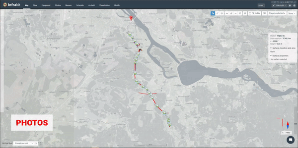
LandXML deviation vector rendering on map and AIS stream support for maritime vessels, to keep all the tools for cooking near to your hand.


Main course: Faster than McDonald’s, better than your local steak house

Time is money. Quality over quantity. How on earth should your restaurant connect those worlds? 

Well to be honest, I am no chef to tell you that… But for infrastructure construction, there is a way!

Now quality and speed do not always need to compromise each other when some intelligent solutions are brought in place. With this version, we have paid extra attention to optimizing various bottlenecks of mega projects. This includes much faster cross-sections, file listings across the system, and faster access to project settings. You do not only have to bring high quality but you can also do it fast now!

Dessert: For all the admins out there – welcome Archive project function


A good restaurant experience tops always on the dessert, which leaves a sweet taste in the buds to make you smile all the way out of the front door. With Infrakit, what could be a better dessert for you to serve to the project, than letting everyone know everything is safe and sound, stored as an Archive project. 

As with everything else, see how to prep this nice desert for your project by archiving your project admin page. Access to the project is removed from all users and equipment easily. Everyone is happy, everyone is safe. What a nice menu it was from the start ‘til the end! 

Now recipes and tools are only for us to focus on the most key part of cooking -> Doing it. That will be the same for building, we can only help you, but you are the Michelin Chefs of our industry, so remember to be proud of that!

Without great restaurants, so many dates, family reunions, and celebrations would be lost.

Without great infrastructure, we would never even get to those restaurants on time safely. Without great infrastructure, there actually would not be much of a society even…

Thank you!

See more in release notes

Jere Syrjälä
August 26th, 2024

Book a Demo

Discover how Infrakit connects your entire infra project operations and drives value to every part of your business.

Infrakit’s products are ready for the Olympic Games with the version 3.9.0!


Infrakit’s products are ready for the Olympic Games with Search and a New look in the version 3.9.0!

Yes, you heard right, our products are ready for the Olympic Games in Paris, which are approaching fast! Where do we compete you might ask? Decathlon!

Javelin, running, BIM, As-built & fleet management, orthophotos, photo & file management, mass hauls, you name it! Take us to the site, that works! Surveying tasks, not a problem!

Hmm, well maybe not javelin and running, but you’ll get the joke I guess 😀

Jokes aside, this new version we just released is a crazy one indeed, our fabulous R&D team has done so many improvements it was brutal practice to pick just a few highlights out of it. But our CEO told me to have just 3 best ones so that you won’t get bored with my blogs (he really cares about you all clearly, saving you from my long stories!), so here they are!

It looks better and it works better with the SEARCH!

I am sure this one has not gone without notice from you, as we took the whole Infrakit to the barber and bought some new clothes, and now it looks much fresher! You cannot attend the Olympic Games without looking like an athlete, right? Not especially if they are in the most fashionable country on earth, France (I am sure our French team agrees 100% on that statement 😉)!

But hey, looks don’t win the games, what does, is how it works! And oh boy this you all have been waiting for. Finally, Infrakit has a SEARCH FUNCTIONALITY! Need to find that one photo of pipe networks months ago… where was it… no more those moments with the search. 😉

And hey, regarding the look, there are many things I want to show you, so maybe we just skip the talk and look at the new buttons and floating dialogs! Here is how they look ->


Megaprojects run smoother than ever now!


Keeping the Olympic Games hype now up as we ended up there -> Think about how much they needed to build new Infrastructure in Paris to facilitate the modern-day Olympic Games… That must be a megaproject itself. This huge stack of new features and optimizations we built for megaprojects to work smoothly did not yet help Paris so much as we just released it, but maybe Los Angeles and the Olympic Games hosts in the future could benefit from it! 😊

What are the things we did then to help megaprojects benefit more from Infrakit, you may ask? I’ll drop a few of them for you: We made it possible to filter docs and images by their custom properties, we optimized point cloud rendering to facilitate huge ones operating nicely, watermarks for images, slopes of 3D lines, flow direction arrows for 3D’s, downloading huge amounts of contents in ZIP without folders, BIM and file browsing speed optimizations… Okay maybe it is easier, if I just drop you the list of release notes here and let you see these things in a video!

And by the way, as we spoke about infrastructure in Paris Olympic Games, they did something spectacular there, by building disadvantaged communities in mind! Talk about sustainable construction! Read about it here

FIELD reporting!


Okay, enough of the Olympic Games, more of the everyday construction. What is the thing that everyone knows needs to be done, but is not maybe the most loved part of work? Yeah, I heard 90% of you said the same, reporting. But it still needs to be done. And especially if you are the one receiving the reports, you definitely know those are crucial!

If talking of precisely reporting on the construction site, our decathlon athlete has a solution for you now in there as well! Our external document feature enables you to have report workflows with the Infrakit FIELD app in so many ways it is hard to tell just one, but one thing is sure -> with this you can make reporting easy and accessible through Infrakit! I’ll show a few ways of it in a video!


Bolstering Trucks page improvements

Talk about receiving some vital information from the running fleet and where they are at the moment when you are running a marathon in Olym… What is wrong with me… I meant to say vital information from your TRUCK fleet… Certainly my Finnish head has not gotten used to this early summer heats in May.

Oh well but hey, do not let the messenger ruin the message! Our superstars from the Mission Control room did some magic for the Trucks page as well, as we can now introduce a few certainly great features: Infrakit Trucks can now trace not only the trips from Load to Unload, but also everything in between, so return trips! This feature we though have behind project settings, so you won’t scare yourself by thinking you have started to see things double after our new release… so let us know if you want it on!

On top of that, we made some great improvements on both downloading data from the page and creating Truck areas through area calculation tool in Map page, see how these work from this video!

Oh wait… What happened to that 3 Highlights… Well, I tried, what can you do when there is so many great new things… Well, I hope you still enjoyed your time reading these rather light-hearted stories of our new features and I especially hope you enjoy using them in your work!

As I mentioned, this was the maximum I can share again, so, it would be very smart from you to check everything we have listed in our release notes, in case there was something great developed that I just did not end up talking here on the blog!

See more in release notes

Jere Syrjälä
May 28th, 2024

Book a Demo

Discover how Infrakit connects your entire infra project operations and drives value to every part of your business.

Mastering infrastructure tenders

Mastering Infrastructure Tenders: Proven Strategies and Smarter Tools for Success

Winning construction tenders for infrastructure projects requires a strategic combination of expertise and effective communication. Tailoring your approach to each project is essential, but three key considerations consistently enhance your chances of success:

Thorough Understanding of Project Requirements:


Innovative and Sustainable Solutions:


Effective Communication and Relationship Building:


Our amazing customers have streamlined their bidding process using our solutions by leveraging our cloud platform as a shared hub for the tender team, facilitating faster collaboration and communication (both internally and with external stakeholders).

With the ability to have PDF documents, DXF/DWG and other design sources, orthophotos, and other base maps, you can work from a common source of truth all on a shared map.


Tools, like Infrakit FIELD (mobile app), and Infrakit OFFICE combine to offer simple workflows to capture and tag photos for undocumented risks during site trips and help tender teams, who generally lack easy access to BIM tools, to visualize 3D elements in the office or the field.

Users can also capture dronemaps for work phase planning, taking advantage of different seasons for comprehensive ground condition assessments.

Book time with our experts to discover how these solutions can be leveraged for improved efficiency and success in winning your next construction tender!

John Frost
January 12th, 2024

Black week offering of Infrakit in terms of version 3.8.7!

Black week offering of Infrakit in terms of version 3.8.7!   

Black Friday, nowadays seemingly more like a black week or two, is without a doubt the most notorious sales day of the year. There are pros and cons to it, but all in all, if you make smart purchase decisions during it, it will be very good time to buy Infrakit as a Christmas gift for your loved ones… Oh… no… I, I meant buying something nice can be smart… Though Infrakit is very nice, maybe I would not give it as a Christmas gift for children. 😀

Ookay jokes aside, our products are maybe not be the ones that are the hottest of the hot during Black Friday, but we still wanted to give you something a bit extra this time, in terms of developing more awesome stuff into our products! Let’s go check them out!


Capture your map beautifully!

How wonderful would it be if you could think of something, and Infrakit would do it as you wish?

Undoubtedly awesome, and even if that is not yet the case today, we took one step towards it by enabling you to select an aspect ratio and area with OFFICE  for your Map image capture tool! We added also some options to modify the legend contents!

Let me teach how to do this via this video!

Powerful metadata in the palm of your hands

Knowledge is power they say. Clichés are clichés not because they are dumb but because they are too true too often.

We want to make you powerful by having all your knowledge of the project in the palm of your hands (especially, if you keep your laptop mouse in your palm). For this, we brought the plan features metadata visible to you, when you click the LandXML!

Watch the video to make this power yours!

Simple but fast… we upgraded your use of files and images into next level

Images and files… So simple things, but yet they can be such a burden so often when they become too many.

If we say knowledge is power, then we say speed is… well, speed. What is interesting in the case of using software like Infrakit, is that speed is not only made by how fast something works, but also how much there are roadblocks to take away your speed. Those roadblocks can be tiny but when you have plenty of them, they become a burden.

We took extra care as a Black Friday gift for you to remove as many small roadblocks of utilizing and viewing images and uploading files in Infrakit. For example image direction is visualized on map helping users to understand the insights from field in deeper depths!

As always it is impossible to tell you everything we did within one blog or you would have to read it as novel… so these are the highlights, but if you have interest on diving deeper to what new we have out there, check them from the Release notes in our Knowledgebase!

Jere Syrjälä
November 28th, 2023

Book a Demo

Discover how Infrakit connects your entire infra project operations and drives value to every part of your business.

Hi Infrakit mobile app user, pay attention – Here is what you need to know about our new FIELD and SURVEY apps!

Hi Infrakit mobile app user, pay attention – Here is what you need to know about our new FIELD and SURVEY apps!

We have heard you. You have clearly not been satisfied with our Infrakit FIELD app, especially on Android devices. You as users and we as developers as well, want it to be a nice and smooth app, which helps you to do your work. (Note: These changes informed in this blog are only considering Android devices, if you are using iOS, you can skip reading this and continue your day!)


To make that smoothness and niceness possible, a while ago we made a decision to reconstruct the FIELD app completely, according to your needs. That process required us to acknowledge, that there is a strong differentiation within the user needs of the app. Some of you needed it for surveying purposes with integrations to GNSS equipment to take points, but some of you needed it rather for taking photos and managing project information.


We saw these different worlds in one app being an impossible combo to keep it simple and intuitive for all. It’s like having Food delivery and Social media platforms in one… Just too complex. Thus, we decided to take action, renew ourselves, and separate the app into two. From now on, there will be two apps, Infrakit FIELD, and Infrakit SURVEY. Now, I bet you are wondering “What are they then about, which one should I have?”. Do not worry, you have the right questions, and this blog can provide you with the right answers!

Infrakit FIELD vs. Infrakit SURVEY

After thinking about the difference for a while, it will seem obvious: Infrakit SURVEY focuses on surveying purposes and making it easy; Infrakit FIELD, on the other hand, focuses on being the project information management tool to be used in the field with your mobile phone.


The new Infrakit FIELD will be a completely redesigned version to be downloaded, whereas the Infrakit SURVEY will be staying as “the old Infrakit FIELD app” as long as we have gone through the rebuilding of it (yea, we are going to rebuild it as well!)


So, if you want to use GNSS devices to make log points transfer to Infrakit, Infrakit SURVEY is the one for you.


If you want to take photos, upload them to Infrakit with geolocation, visualize project information on the map such as models, or manage documents, the Infrakit FIELD app will be designed for you.


Now that the difference and what you have to do are elaborated, it is time to introduce the new Infrakit FIELD app core functionalities for you!

Infrakit FIELD -> Photo taking & management on site

Infrakit FIELD -> Visualize and check project information on FIELD


As mentioned earlier, the Infrakit SURVEY app will have the functionalities of the “old Infrakit FIELD app”, just under the new name, so we will not present them at this stage, but during 2024 when we aim to do the reconstruction!

For more app-using instructions, go check out our manuals from Knowledge Base!

Jere Syrjälä
September 7th, 2023

Book a Demo

Discover how Infrakit connects your entire infra project operations and drives value to every part of your business.

Drag-and-drop orthos are here with Infrakit version 3.8.6!

Drag-and-drop orthos are here with Infrakit 3.8.6!   

I bet hearing these stellar news will make even chief journalists of Times, Wired, and other of the world’s largest Magazines envy my position as a notorious Infrakit blog writer since I am the one that gets to first tell them… 😉 

Okay, are you ready to hear it… Infrakit eats now orthos itself!  

Now that it’s said and done, let’s take a bit deeper look into what this means for your work! 

Stoop stop stop! I want to steal your attention still for a second before getting into the text -> Our Thesis worker Jetro has worked super hard for this feature to become captured reality (you see the pun intended 😉), thus, I would love to see you giving him a minute or two of your opinions regarding this feature. Link for a Master’s Thesis questionnaire at the bottom of the text, Let us help Jeti!!


Getting orthos into Infrakit has never been easier… 

Would be cool to demonstrate my newly learned skills among orthophotos by explaining to you technical buzz-words to make you break a sweat « Oh this guy knows what he is doing ». But honestly, the feature is so simple that a chimpanzee could use it, so I guess my days of acting cool are over… I mean basically, just by dropping the files into Infrakit you can get access to your orthos in Infrakit Map, Now think about that! 


Let me rephrase this from your point of view. Your work life will get a ton easier by having the relevant and up-to-date information in the form of orthophotos readily chewed up on Infrakit because this feature lets the drone gurus do that so quickly! 


Currently, supported file formats are .tif, .tiff, and .jp2, and all the necessary knowledge and information on using this feature can be found in our KnowledgeBase. 


Check the easiness of this from this video!

… and they can be opened in third-party as well! 

Until Matrix comes alive there is not a single system that can perform everything needed everywhere in one place. Not even Infrakit can solve everything on its own and we quite humbly recognize that. Thus, as always, we want to be as flexible as possible with other awesome software out there, making your life easier when jumping from one software to another! 


For this, we pursue making the opening of uploaded orthophotos in third-party systems superbly smooth! Go check how this is done with Civil 3D from the video below, and other cases from our Knowledge Base!

And a special announcement for integrators and customers having their own pipelines for orthomosaic processing! Please contact us for guidance on super simple APIs that make sharing your content with Infrakit users a true delight.

Super Sharp DWGs!  

You tell us and we hear you! DWGs are essential data to be visualized for you on the Infrakit platform and that is precisely why we have been going the extra mile to make them super sharp and functional for you.

Now we dare to say the version 3.8.6. starts to have them in a fashion that is ultra crisp and clear, take a look at yourself!

For all Autodesk users out there! Now you can also download as-built as a DXF file, data nicely organized to layers by codes.

Pssst… If you are a hardcore Infrakit user, here is a little easter egg for you -> go check what is new on the Infrakit Admin page… or rather, what has made its return 😉 


AND HERE IS THE LINK TO JETRO’S QUESTIONNAIRE! JA TÄSSÄ LINKKI SUOMEKSI!

Check the more in-depth list of new features and improvements of this version from our Knowledge Base

Jere Syrjälä
September 12th, 2023

Book a Demo

Discover how Infrakit connects your entire infra project operations and drives value to every part of your business.