Survey engineers play a critical role in infrastructure projects. They are often the link between planning and execution — ensuring that the right information reaches the right people at the right time.
In reality, this responsibility often comes with a heavy administrative burden. A large part of the day can be spent answering questions, sharing updated drawings, and making sure everyone is working from the latest version of project data.
Pernilla Eriksson, Solutions Engineer Infrakit hosted a webinar exploring how these challenges can be reduced through better access to information and more efficient workflows.
When information becomes a bottleneck
In many projects, survey engineers become the central point for information. While this is essential, it can also slow things down.
Common challenges include:
- repeated questions from the field
- manual sharing of PDFs and drawings
- multiple versions of the same documentation
- fragmented communication across teams
Over time, this creates inefficiencies and increases the risk of errors — especially when teams are not aligned.
Creating a shared source of truth
One of the key takeaways from the webinar is the importance of having a single, shared platform where all project data is accessible and up to date.
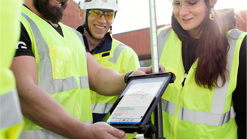
With a solution like Infrakit, information is no longer dependent on individuals. Instead, everyone — from office staff to machine operators — can work from the same data in real time.
This not only improves collaboration, but also reduces the need for constant coordination.
From manual work to efficient workflows
During the live demo, we showed how digital tools can simplify everyday tasks for survey engineers.
Clear visualisation of models
Access to both 2D and 3D models makes it easier to understand project details such as terrain, slopes, and underground structures. This improves communication and helps avoid misunderstandings.
Faster answers with cross-sections
Instead of going back and forth to explain how something should be built, cross-sections provide a clear and immediate answer — directly in the context of the project.
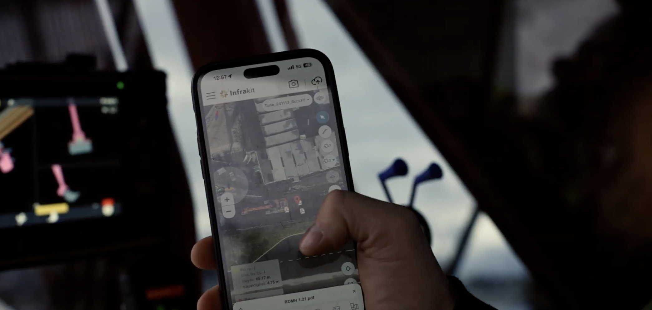
Finding the right drawings, instantly
Geotagged PDFs make it possible to quickly locate the correct drawing based on location. This reduces time spent searching and minimises the risk of using outdated information.
Better documentation with photos
Capturing and sharing photos directly in the platform allows teams to document progress, track deviations, and ensure proper follow-up.
Supporting production through integration
By integrating with machine control systems, project data can be used directly in production. This reduces manual handling and improves overall efficiency.
More time for what matters
By improving how information is shared and accessed, survey engineers can spend less time on coordination and more time on their core responsibilities.
The result is:
- fewer interruptions
- better collaboration
- reduced risk of errors
- more efficient project execution
Watch the full webinar
If you missed the session, you can watch the full recording here: https://youtu.be/rz7ijW-NsEY?si=ARrz3ep8-w4ruJNv
Final thoughts
Improving workflows in infrastructure projects is not just about working faster — it’s about working smarter.
By creating a shared source of truth and reducing reliance on manual processes, teams can improve both productivity and project outcomes.
Want to see how this could work in your projects? Book a demo with our team https://www.infrakit.com/request-a-demo/