CASE: YIT – E18 Hamina-Vaalimaa Motorway
Starting Point and the Need for Change:
”Monitoring, quality control and management of the big picture in my previous project was challenging, because we had multiple different practices in use. Monitoring the project progress was much more difficult than it needed to be”, tells Jussi Laamanen, Quality Manager of YIT.
“The main thing to understand about the project is that the Hamina-Vaalimaa motorway is 32 kilometres long. It is one enormous project divided into five separate subprojects. My goal is to have one data management practice in use instead of five different ones.”
Solution:
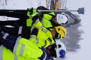
Infrakit was taken in use in E18 Hamina-Vaalimaa project for on-site managers, foremen and surveying staff (~30 licences in total) and for 22 3D machine controlled equipment. Infrakit App for tablet is also in use in the project.
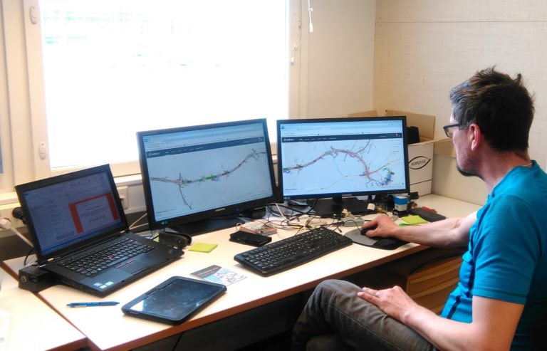
Infrakit on Laamanen’s PC
Benefits:
“The design material volume alone is ~40 000 pages and, in addition, during construction the documentation can rise up to a total of ~70 000 pages. With the help of Infrakit, five pages become two and everything is online in your tablet where ever you go. Monitoring is much easier. When I have shown the project owner the previous way of reporting and compared it to this, most of the suggestions have been approved. Not even the project owner wants the absurd amount of paper. They want to see the relevant data, as do I”, describes Laamanen.
“Infrakit has enhanced performance in the field as well. We have been able to decrease unnecessary overlaps with specific naming processes: files are named under one precise name. The files are stacked in the project bank on top of each other – the latest updated one is always on top of the others. If and when someone wants to see the revision history, it can be seen in the background.”
“One feature that has gained a lot of praise from the field staff, is the photographing feature. Taking photos is made simple – you can just push a couple of buttons and it ties the pictures to a specific location automatically — and you don’t need a space scientist’s education for it! It is easier to view and locate photos afterwards, when you can see the specific data and description of the photo in the file name”, tells Laamanen.
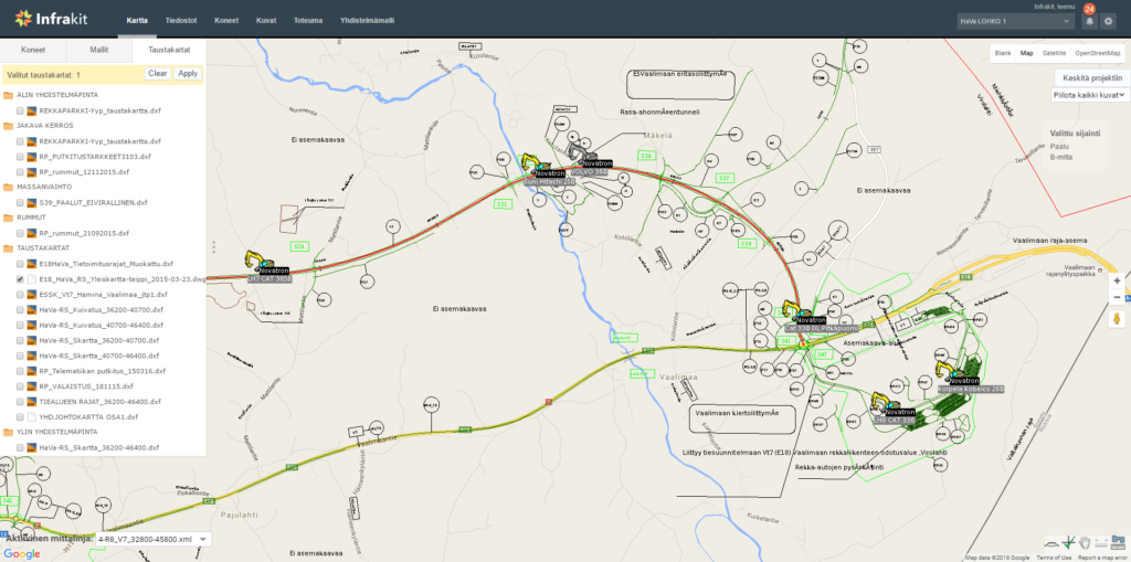
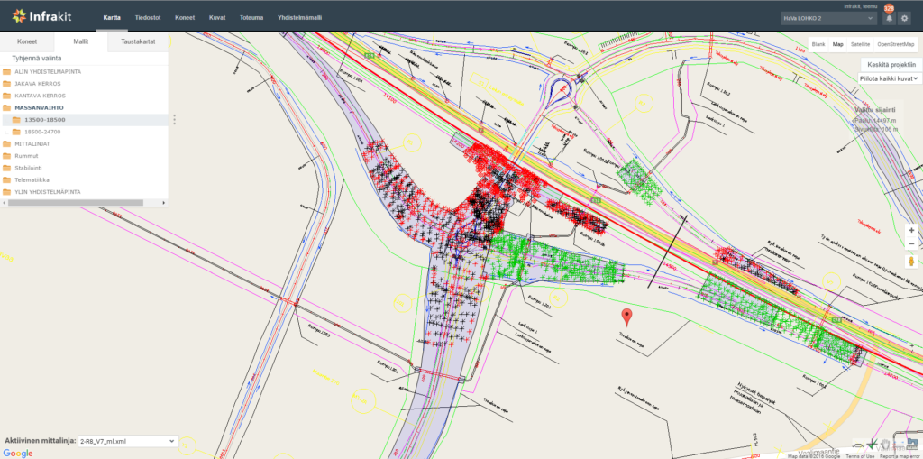 The map view of Infrakit from subproject 2
“From my point of view as the Quality Manager, Infrakit makes monitoring the project in the field so much easier. There is no need to travel 35 kilometres for every little thing when I can just check it from my PC screen at the office. I am not tied to a time or place. It has been a big relief — I can see in real-time how the project is progressing.”
“Before this I did not have a tool for monitoring project progress as an entirety. Overseeing the project depended on my own observations and comments received from foremen and surveyors. It was basically like flying blindfolded. You never really saw the whole big picture. Now thanks to Infrakit, I can see the real-time situation and the progress that we have made. It’s the same thing on the field. Previously you basically needed to guess your location: ‘am I now here or am I there, one kilometre to the left or right?’”
“It used to take us months at its worst to share and receive information. Infrakit is real-time.”
Changing the landscape
Infrakit App + GNSS
Difference to the traditional methods:
“It is rather interesting to see how you can place yourself on the map now. It is an awful lot of work for land surveyors to mark everything with measuring sticks. Now when the sticks are not needed, they can concentrate on relevant tasks. If one phase used to take two hours to be done previously, now it takes 30-45 minutes. It is a big difference”, Laamanen clarifies.
“Also the excavator drivers want to show us their know-how. They are aware that we can see the as-built points at the office and they have been given clear instructions, where to go and which layer to reach. And the thing I have noticed while monitoring the accuracy of the machines, is that some of the drivers work within an accuracy of one centimetre. They want us to see that ‘we’ve got this, we know how’”.
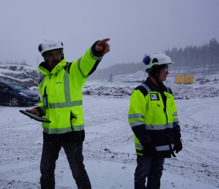
Infrakit map view of subproject 1, machines on a move
Would you recommend Infrakit?
” Yes I would. Whether the project is 100-200 metres long residential street or dozens of kilometres long motorway, you should have Infrakit in use. You will see the benefits when you start using the software. Now I would never give Infrakit up, it would be catastrophic for my project. The Hamina-Vaalimaa project is 32 kilometres long: the distance from my office to the beginning of the road is 10 kilometres and to the farthest end of the project 45 kilometres. It saves a lot of my time when I don’t need to drive back and forth. I can see the progress on my screen”, praises Laamanen.
E18 Hamina-Vaalimaa -project comprises 32 kilometres of new motorway and the related road arrangements. The road section yet to be built is the final section of E18 motorway that will cross Finland from Turku to the eastern border. Arranging the heavy machinery traffic in Vaalimaa is part of the project. In addition, pedestrian and bicycle ways will be improved and additional lanes will be constructed.
For more information click here: http://www.liikennevirasto.fi/en/e18-hamina-vaalimaa
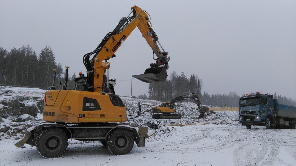
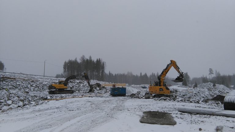
Machinery at work at subproject 2
Editor’s note:
E18 Hamina-Vaalimaa project is only in its early stages. This customer case will be carried out in several parts. Part 2 will be published around Fall when the technical aspects of the construction have progressed and there is a motorway ramp on the project site 2 (pictured in the case).
![]()
![]()
Published on April 20th 2016.