Surveying Tool in your Tablet
Infrakit App has a new feature: “surveying” tab.
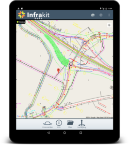
Infrakit App on a Table
Location data and surveying features were earlier under “advanced mode” tab. Now land surveying is made even easier so that every App user has an access to centimetre-precise location data from an external GNSS device.
If you don’t need so precise location for some tasks, you can use your Android device’s own GPS sensors or external GNSS device with DGPS location free-of-charge service provided by National Land Survey of Finland. Land surveying becomes real-time when you can do that while also designs and as-built data are shown on the same screen on the Infrakit platform.
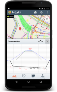
New User Interface with Cross Section (mobile)
Infrakit App supports most GNSS devices, such as: Javad, Topcon, Leica, Trimble, CHC, Stonex, Spectra Precision and more.
It’s now also possible to share your location in the App. That means that any Android device – tablet or mobile – equipped with Infrakit App is shown on the map, for example as excavator or truck icon. This way machinery or even a staff member can be a part of Infrakit map view.
We are developing Infrakit App continuously, so please make sure that you have the newest version updated on your device. Read about some user experiences here and the App launch (June 2015) from here.