InfraBIM Open – sustainability beyond digitalization
InfraBIM Open – sustainability beyond digitalization

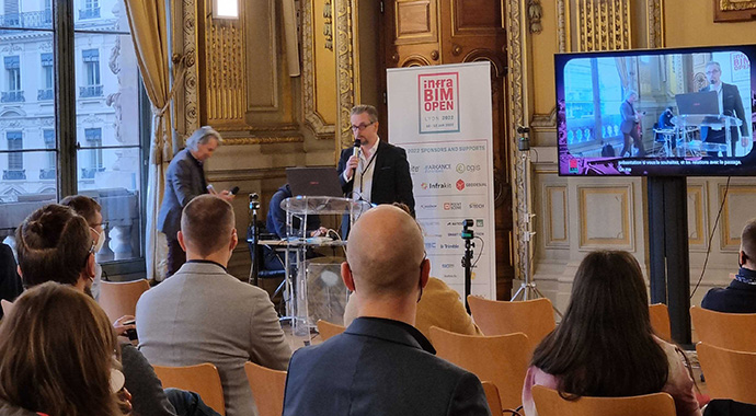
InfraBIM Open was held in Lyon, France on January 10.-12. The event started with an opening session on Low Carbon on Tuesday morning. Between the scheduled presentations, conversation at the stands flowed between partners and customers with people enjoying face-to-face interactions. One main theme for us throughout the event was sustainability through and beyond digitalization.

Presentations were held on Tuesday by Sebastien Cailliau General Manager Infrakit SARL (Infrakit overview) and Pasi Joensuu VP of Business Development (How are digitalization and sustainability connected in construction industry)

“This event suffered clearly because of Covid, but it was important to have it. Despite the pandemic, we had ca 200 people present during both days, which was good, and the same number of people were present online. On a personal level I found it interesting to get to know more French companies and to speak to them about the digitalization level in France.

During my presentation I got a good connection with the live audience. They lived with me through the presentation, and I believe that it will bring something for the future. People understood that sustainability beyond digitalization is what we need to aim for. Sustainability is important because it will affect the world, we will leave to future generations. It was a suitable time to share our vision and have a public dialogue.” Pasi Joensuu

“Infrakit France was very happy with the event. First, the organizers did a respectable job managing a physical and online event considering the Covid situation. We were delighted to see that professionals did come to Lyon for very interesting exchanges about digitalization of their current operations and worksites. It makes no doubt that all companies now, from majors to smaller companies take a close look at proven solutions like Infrakit to speed up their digitalization operations and benefit from accrued quality, communication and saved costs on their projects.” Sebastien Cailliau

On Wednesday, our Development Manager Manu Marttinen and Sami Ylitervo CEO, Survey & BIM Manager of NORD SURVEY presented a case study on the Use of openBIM platform in entire life cycle of infra project in mining industry in Finland.

“I enjoyed the many conversations and presentations that the event made possible with other experts of our field. The organizing was done well, and I was happy to present our case at the event with Sami” Manu Marttinen

“It was wonderful to be able to participate in an event where top experts had gathered for discussions and presentations related to the industry. I want to thank everyone for their inspiring presentations and meetings, which have been thought-provoking. I look forward to working for an even smarter future with our team, customers and partners.” Sami Ylitervo

Thank you to all organizers, speakers and participants for a lovely event!

Damyanti Rathore
January 28, 2022

Book a Demo

Discover how Infrakit connects your entire infra project operations and drives value to every part of your business.
Infrakit enabling worksite efficiency – Watch the video

Infrakit enabling worksite efficiency – Watch the video

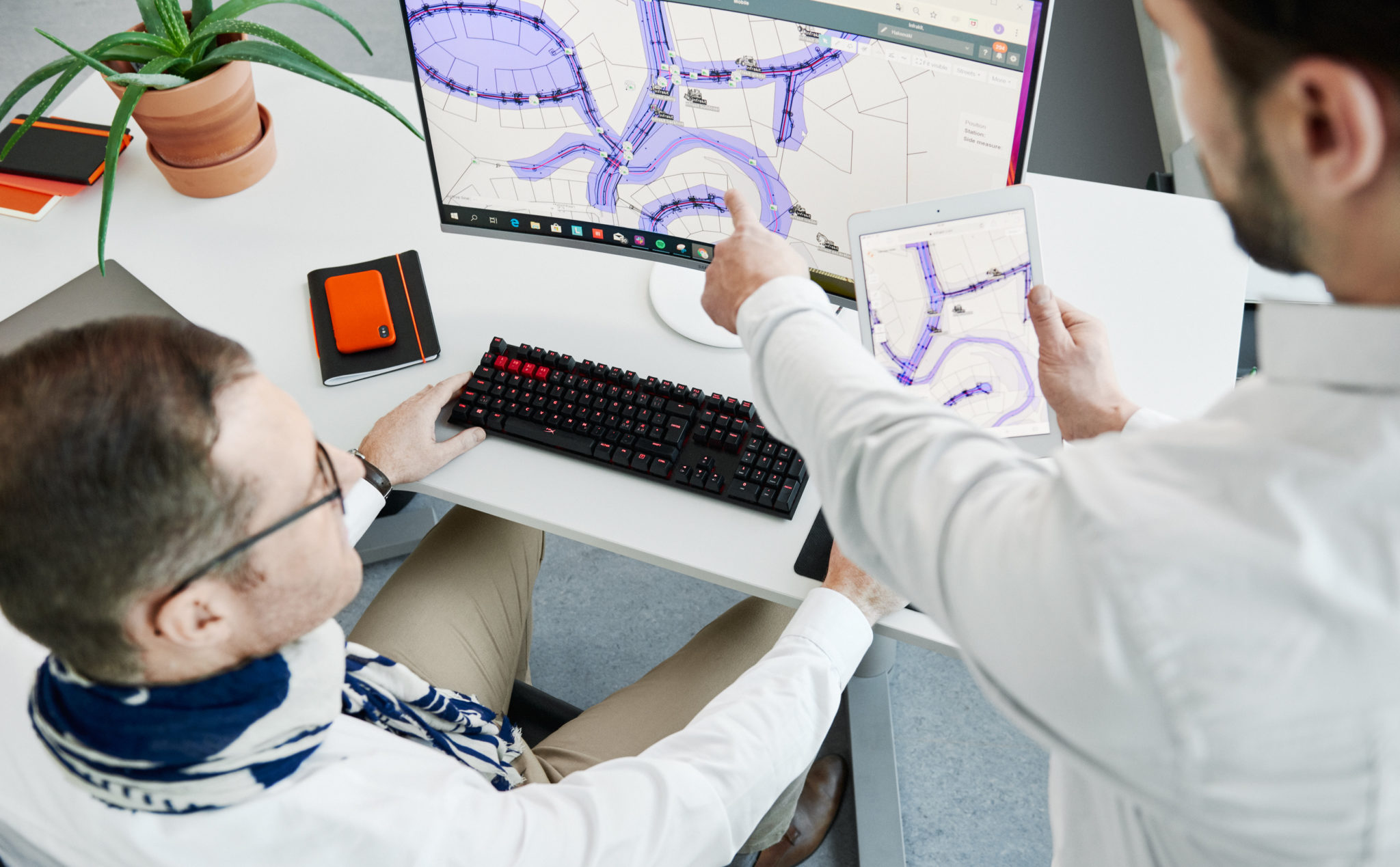
​The second Infrakit in action video has been released. By providing fast access to digital project data the Infrakit cloud boosts worksite efficiency. Forget about paper printouts. Infrakit visualizes up-to-date plans conveniently on your mobile device. Data is easily found, because georeferencing allows access to data that is close to your location.

3D designs, typically generated for machine control, can be visualized on field to enable 3D access to all workers, site supervisors, and everyone on the project.

When Infrakit is connected to external RTK sensor, application guides the user to correct grade and position in high accuracy. Collecting as-built data as you go enables remote monitoring of site progress and quality control.

Infrakit allows filling out preset PDF templates and sharing of document reports to whole project team in real-time. Powerful photo management with geotagging and alignment referencing assures all pictures are found later when needed for illustrations in project meetings and at later stage for project handover.

With Infrakit, site personnel have convenient access to the digital project content and are enabled for streamlined, real-time reporting of project status. Watch the video below.

Damyanti Rathore
January 21, 2022

Book a Demo

Discover how Infrakit connects your entire infra project operations and drives value to every part of your business.

Welcome to InfraBIM Open 2021-2022 on January 10.-12. in Lyon

Welcome to InfraBIM Open 2021-2022 on January 10.-12. in Lyon

InfraBIM Open will be held in January as a hybrid event with the in-person event taking place in Palais de la Bourse CCI, Lyon. Infrakit will be participating in person and online. Read more and get your tickets for the event here.

Opening times are:

10.1.2022 4.30 pm until 12.1.2022 6pm

To attend InfraBIM Open you need:

as a physical participant: a sanitary pass (vaccination scheme) or a negative antigen test 48h or a negative PCR 72h for entry by presenting a QR code (for foreigners How to obtain a health pass in case of vaccination abroad? Santé.fr (sante.fr) ; for French people application Tousanticovid ; please notice that the sanitary protocol inside the venue has been reinforced.

as virtual participant: join the live event by Brella also used for networking and translation (link will be sent on January 3rd)

Damyanti Rathore
January 5, 2022

Book a Demo

Discover how Infrakit connects your entire infra project operations and drives value to every part of your business.

Geo Business 2021 – building brand awareness

Geo Business 2021 – building brand awareness

Geo Business 2021 was held at London Excel on November 24th-25th with over 100 exhibitors presenting live. A definitive highlight of the event was having people tell us they were advised to visit us because of our expertise in digitalization in the industry. Notable mentions are Hexagon and Makin’ 3D.

Our VP of Business Development Pasi Joensuu recalls from the event “The best meeting, I had was when a surveyor came to us with challenges regarding multi-fleets and their manager came to continue that conversation and how to share data in a multi brand environment the following day. Another highlight was when several consultants came to us for advice on how we can provide better information on project progress to the owner.”

“Overall, the feeling after the event is positive, all the conversations we had at the booth were relevant to us. Visitor demographic ranged from university professors to students, machinery salespeople and construction professionals on many levels. A personal highlight for me was when one of our partner’s division leader followed me to let me know they have not forgotten about us; we will get back to this in January” he continues.

Damyanti Rathore
August 10, 2021

Book a Demo

Discover how Infrakit connects your entire infra project operations and drives value to every part of your business.

New Infrakit release 3.7.6

New Infrakit release 3.7.6

Map tile manager

New map tile manager enables multiple WMS/WMTS sources and multiple drone flights to be visualized at one view. Ordering tool allows setting the layers to desired order and transparency slider makes it easier to detect deviations between map tile sets. This can be used to trace progress or to analyze many initial data sources at one view.

Shape file support

Now it is possible to bring GIS data to Infrakit in Shape format. This enables visualization of initial data together with other data sources, such as map tiles and design data in the same view. The video below illustrates how areas, lines and points are visualized on 2D and 3D views of Infrakit.

Stringline models for 3D visualization

LandXML stringline models turn alive in the 3D view of Infrakit. Stringline model means continuous surfaces created from set of independent breaklines. Stringline models are widely used for machine control, especially in Norway. New features enable more powerful model checking before files are sent for machinery. Thanks to cloud access, visualisation is also possible to stakeholders who are not familiar with, or do not have access to modeling tools.

Damyanti Rathore
August 10, 2021

Book a Demo

Discover how Infrakit connects your entire infra project operations and drives value to every part of your business.

BIM World Munich with a focus on connecting with stakeholders

BIM World Munich with a focus on connecting with stakeholders

Since 2016, BIM World MUNICH has been the leading networking platform in D-A-CH for national and international players in the digitization of the construction, real estate and infrastructure sectors. With speeches from 150 experts around the world about topics surrounding sustainability and innovations for the future our focus was on direct contact with customers, colleagues and partners.

“We are always delighted to be part of the Finnish Pavilion at BIM World Munich for the opportunity to talk to BIM Managers, students, fellow software companies as well as our customers and partners. As an open technology platform our goal is to collaborate – with customers, machine control systems, surveying companies, integration partners and universities. BIM World has all that in a very familiar setting. We were able to discuss industry workflows and ways to improve efficiency and sustainability in infra projects while learning how to refine our products even more. ” Nils Spannuth Sales Manager Infrakit Deutschland GmbH recalls.

Teemu Kivimäki Founder and CEO of Infrakit Group Oy said, “The highlight for me this time was having the opportunity to meet and talk to our stakeholders face to face to discuss further cooperation in the future and gain more insight into their needs and wants”.

Damyanti Rathore
August 10, 2021

Book a Demo

Discover how Infrakit connects your entire infra project operations and drives value to every part of your business.